
Location
Other maps: Bing, Google, MapQuest.
Coordinates: 36.0902, -80.5404.
Type: Sight
Tour: Wachovia
County: Yadkin
![]() Partial
Partial
Shallowford Farms Popcorn has kindly agreed[1] to let visitors park at the end of their first driveway, marked by the coordinates (not in their parking lot driveway, please).
Park at the edge of the driveway, facing in the direction you were driving, and keep an eye out for company trucks. Before you leave the area, consider stopping into their gift shop to load up on locally produced treats for your trip![2]
Context
 As the British Army under Lt. Gen. Lord Charles Cornwallis prepares to enter North Carolina from the south, Loyalists are gathering to join him.
Situation
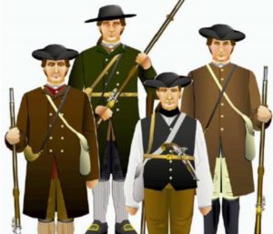
Loyalist
Supporters of King George from this region gathered at the Moravian village of Bethabara under Col. Gideon Wright. Then they marched toward Charlotte where the British were camped. However, they raided Patriot homes along the way for supplies and for revenge. The Loyalists (“Tories”) camped on the east side of a ford at the Yadkin River for two weeks to continue their attacks.
Patriot
Most of the local part-time Patriot soldiers called “militia” had gone south with the Overmountain Campaign to attack a British corps, resulting in the Battle of King’s Mountain (S.C.). Capt. Andrew Carson, who was probably left behind to protect the home front, lived west of the ford. When Wright camped, Carson rode 62 miles round-trip, overnight, to Col. William Davidson in Salisbury, who gave him 52 men to pursue the Tories.[3]
Date
Saturday, October 14, 1780.
Timeline

Imagine the Scene
Over the Hill and Through the Woods
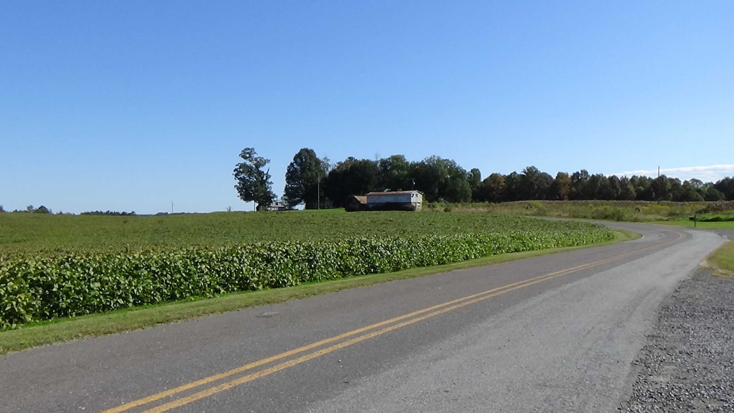
Look past the buildings down the road, to the house in the distance.
Running past the house side-to-side on the day of the battle is the Mulberry Fields Road, a dirt wagon road between Salem and Mulberry Fields (modern Winston-Salem and Wilkesboro). By sheer chance, 160 Virginia Patriots who had left home too late to join the Overmountain Men learned of the Tory actions, and headed east in search of them along that road. One of them said the Virginians learned where the Tories were from an African-American “who they tucked up and whipped until he informed” them.[4]
They ran into the 150 militia Carson had gathered somewhere to the left, probably over the hill in that direction. Not part of the regular army, these men wear regular clothes and carry their personal weapons. Most have muskets, but some Virginians carry more accurate rifles. All probably ride on horseback past the modern house heading for the ford.
Today’s road joins the old one’s route around the house, running sharply downhill to the right. This entire area was still wooded, which helped cause a surprise.
If you want to follow the militia part of the way, drive past the house and downhill to the end of the road. The wagon road continued across a small stream that runs from left to right behind the modern homes, now called “Battle Branch.”
Officer Death and Cowardice
Drive to the battle site:
- Return to Courtney-Huntsville Road.
- Turn left.
- Drive 1.3 miles through Huntsville, curving left through town, and turn left onto Mulberry Fields Road.
- Drive to the end.
The road turns to dirt, but there is a turnaround at the end. Public right-of-way extends to this area. Please respect the property owners’ rights by not going beyond the gate.
You are back on the original road. The first of between 350 and 500 Loyalist militia are riding up and then down the road from the river behind you. Some of their number are still crossing the ford, about a mile from here.
Wright and his brother “‘are at the head of these Banditts (and) Plunderers, whose ignorance is to be dreaded, having not the least principles of Honor or honesty.’”[5] Once source says the Wrights were former New Yorkers who fought in the French & Indian War. After moving to N.C., Gideon gained permission to build the Surry County Courthouse on his land in 1771, and he became a justice of the peace. He joined Royal Gov. William Tryon against the Regulators that same year.[6]
The start of the fighting here is shrouded in mystery. Few veterans tell details when applying for pensions years later, and no two tell the same story. For example, two mention breakfast, but one says the Tories were surprised while eating theirs, and the other says the Whigs were![7] Henry Trolinger, who provides the most detailed tale of the battle, at least confirms both sides were surprised: “We met unexpectedly (and) hastily formed” into battle lines, he said.[8]
Where that happened is not clear either. But it seems to be somewhere between Battle Branch, at the bottom of the slope in front of you, and the ridge where Courtney-Huntsville Road runs behind you.[9]
“The commander of the enemy was immediately killed, five rifle balls having gone through him & his horse,” Trolinger continues. Actually, this was Capt. James Bryant. “The enemy fell back & formed again.” That is, the Tories draw back and form another line somewhere near you. The Patriots advance tree to tree and continue firing.
At some point Patriot Pvt. Henry Francis is behind a tree with another man shooting in this direction. His father, Capt. Henry Francis, is “killed a few steps from me,” he says, by a shot through the head.[10]
The two sides exchange more rounds. Outnumbering the Patriots, the Tories hold their ground at first, but the Virginia sharpshooters take their toll. At some point Patriot Capt. Isaac Campbell can’t take it anymore. He panics and flees down the hill.
Soon the Tories join him, in a sense, but running the opposite way toward the ford. Some supposedly yell “we are whipped!”[11] The Patriots rush toward and past you.
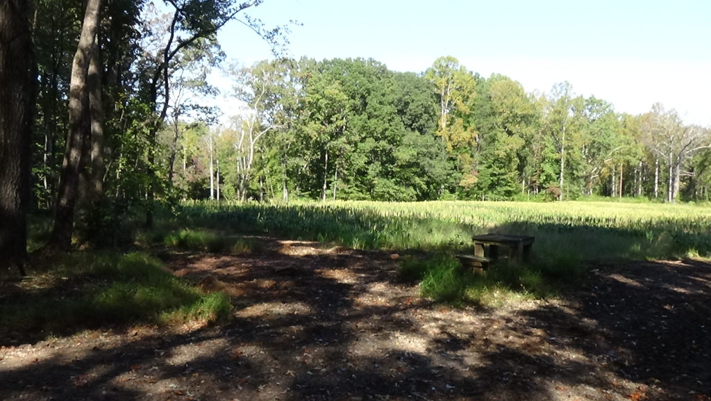
After the battle, Capt. Francis was buried somewhere in the trees on the far side of the field, out of sight, near the former road.
A Tory Pays for His Courage
Follow the Tories. At Courtney-Huntsville Road turn left, just as the old road probably did around this point. Drive a tenth of a mile and take the next right, Shallow Ford Lane. Drive to the cul-de-sac at the end and look into the wooded ravine to the left.
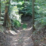
The original roadbed is on private property on the other side of the ravine. No doubt most of the Tories are not bothering to go that far, and are pouring through the ravine toward the ford downhill.
However, one source says, a Tory fights to the end. Perhaps within your view, an African-American named Ball Turner supposedly finds a protected spot and continues firing. Eventually a group of Patriots figure out his location from the puffs of gun smoke. They charge his position and kill him.[12]
Fording to Safety
- Go back to Courtney-Huntsville Road and turn right.
- Drive 0.7 miles, and turn right into the unpaved entry to the Bob Pate Memorial Access Area, near the bridge over the Yadkin.
- Park near the river.
The ground here is uneven and often muddy, but you cannot see the ford area from a vehicle. Walk to the small boat ramp, which is hard to see until you get near the water. Go as close to the river as you safely can. Look to the right where the river turns out of sight downstream.
In the middle of the river is an island of silt collected on a long outcrop of rock. (In summer, its trees are almost impossible to separate from those in the background on the other side.) Possibly not there at the time of the battle, it marks Shallow Ford. As this was the only ford on this part of the Yadkin River that could support wagons, it was heavily used for many years before and after the Revolution. Roads from the ford led to the Moravian towns around Salem in the east and Salisbury to the south, in addition to Mulberry Fields. (The roads are still partly visible, but are not yet accessible to the public.)
Shallow Ford has a solid, level rockbed 100 feet wide and roughly 100 yards long, crossing the river diagonally. At normal levels it was around 18 inches deep. On the west (right) side, a boulder called Ford Rock served as a warning sign: If it was covered by water, the crossing was too dangerous.[a]
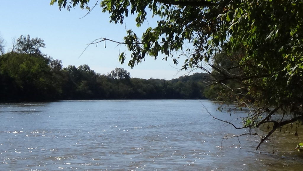
Early in the morning of the day of battle, you see through changing leaves the Tory militia. They are riding down the far slope toward the island in a column, most or all on horseback. The rear of the column is still making its way across when you hear the gunshots from the battle breaking out. The column hurries its pace, but not all are across when the movement stops. Men from the front start splashing back to the left, some probably on foot, having abandoned their horses. The rear turns around and retreats back to the left as men run past.
The battle has lasted all of 45 minutes. But it is one of several that prevent Loyalists from joining the British at the pivotal Battle of Guilford Court House the following March. The lack of militia troops to put up against many hundreds of Patriot militia at that battle helps explain the mortal damage done to Cornwallis a month after he crossed Shallow Ford.
Cornwallis Crosses
Due in part to the defeat of his western wing by the Overmountain Men a week before this battle, Cornwallis called off his 1780 invasion. Hundreds of prisoners from King’s Mountain crossed the ford toward Bethabara ten days after this battle. In January, after a large number of well-trained soldiers were captured at the Battle of Cowpens (S.C.), Cornwallis chased their captors in what has become known as the “Race to the Dan.” Those prisoners crossed here as well.
Starting on Tuesday, February 7, 1781, and continuing into the next day, the British army crosses here from right to left. They are headed to the Moravian towns to resupply during their pursuit of the Continental Army of Maj. Gen. Nathanael Greene. Greene had crossed at the Trading Ford downriver a week earlier, but the river was too high for Cornwallis to follow him. The British started to camp in Salisbury until it dropped. Cornwallis decided he could not wait any longer and must take the longer route via this ford. Given that he assumed Greene was headed for the upper fords of the Dan River at or west of modern Danville (Va.), it was not that far of a detour.[13]
The crossing by around 2,400 men, along with camp followers and cannons, likely takes around six hours—not counting an overnight halt due to darkness. They camp on a plantation,[14] and continue to Bethania the next day.
The Patriot militia cavalry of Col. Joseph Graham had slowed Cornwallis near Salisbury and dogged his march all the way here. You see it arrive in time to cross over, climb the far hill, and watch the last of the Redcoats march away.
Graham says he posted most of the men at the ford and then with 20 others rode after the British. They caught up to end of the column, 50 cavalry dragoons, some three miles away. After following them a couple of miles, the militia headed back. On the way they found some stragglers, capturing in separate incidents four Redcoats and two Tories, and killing a Hessian (German mercenary) who refused to surrender[15]
You can catch a glimpse of the ford by turning right out of the Access Area and crossing the bridge. Ripples in the water on the right side of the island, perhaps reflecting sunlight depending on the time of day, show the river is shallow there.
Battle Map

The Battle of Shallow Ford: All positions approximate except original roadbed. 1) Patriot militia approach Shallow Ford from the west as Tories cross it from the east. 2) Patriots and Tories surprise each other, form lines, exchange fire. 3) Tories fall back, lines re-form, and firing resumes. 4) Tories break, retreat across the ford with Patriots following.
[1] Vestal, Sam, Shallowford Farms Popcorn, Phone call, 11/9/2020.
[2] AmRevNC.com has no financial ties to this company. We just appreciate their sharing their driveway!
[3] “Pension Application of Andrew Carson, S8173.”
[4] “Pension Application of Ezekiel Reynolds, S2013.”
[5] Thus a Patriot major had described them to a general earlier, in a letter seeking help (Jones 2011).
[6] Salter 1996.
[7] “Pension Application of William Brothertin (Brotherton), S1793” and “…of William Lesley (Leslie), S31821,” respectively.
[8] “Pension Application of Henry Trolinger (Trollinger, Drollinger), W4087.”
[9] The only common elements in the few pension applications providing details about the battle’s start are mutual surprise, near a crossroads or fork, a mile west of the ford. The ridge along which Courtney-Huntsville Road runs is about a mile west of the ford, and a historical map of Yadkin County shows Huntsville as a crossroads at the time (Hughes). There is no evidence to support a local tradition that the forces started firing from different sides of Battle Branch, or that the Patriots set an ambush. Brownlee (2011) concurs. None of 130 pension applications mentioning the battle refer to a stream or valley, or use “ambush” or a synonym. One widow reports her husband talked of “being engaged in a battle at a sinkhole kind of a place at or near the Shallow ford” (“Pension Application of Thomas Evans, W923”). This seems to better describe the ravine leading to the ford, however.
[10] “Pension Application of Henry Francis, R3739.”
[11] Reported by George Kimbrough, believed to be an enslaved man who had been fishing (Phillips 2022).
[12] Ibid.
[13] Pancake 1985.
[14] Sherman 2007.
[15] Graham 1904.
[a] Phillips; normal depth from Reynolds (1989).