Neutrals Host the British Army
Location
Other maps: Bing, Google, MapQuest.
Coordinates: 36.1785, -80.3392.
Type: Sight
Tour: Wachovia
County: Forsyth
![]() Partial
Partial
The heart of Bethania retains the feel and street grid of the town founded in 1759. Start in the parking lot at the Bethania Visitor Center. Consider touring it if open to learn more about the town’s fascinating history, and pick up walking tour and trail maps. Our page focuses on the most dramatic visit in that history, during the American Revolution.
Seeing everything well requires walking on rock pathways and hiking a short forest trail. Most spots can be seen from a vehicle either in passing or by briefly parking in narrow side streets.
Context
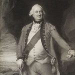
 The British army of Lt. Gen. Lord Charles Cornwallis has chased a Continental Army from west of Charlotte, in what today is called “The Race to the Dan.”
Situation
British
With the Yadkin River still too high to cross at the Trading Ford near Salisbury, where the Continental Army had escaped using boats it kept on its side, Cornwallis decided to move upriver and cross at Shallow Ford directly west of here. He hoped to resupply at the Moravian towns in this area, because he burned most of his wagon train and supplies at Ramsour’s Mill (in modern Lincolnton) to move faster.
Continental
Maj. Gen. Nathanael Greene’s army had camped at Abbott’s Creek south of Salem to observe Cornwallis. Once he learned of Cornwallis’ move, he shifted north toward Guilford Court House (in today’s Greensboro) in hopes of confronting the British there.
Moravians
Members of the “United Brethren” or Moravian Church, mostly immigrants from Germany or their descendants, had built a half-dozen towns within the 98,000-acre Wachovia Tract in what became Forsyth County, including Bethania (“beth-A-ni-ah”). They were peaceful by doctrine and did not join armies. They have tried throughout the war to stay neutral, feeding and selling goods to both sides, and thus have suffered abuse from both sides.
See “Historical Tidbits” below for more on Bethania.
Date
Friday, February 9, 1781.
Timeline
Imagine the Scene
Marches Down Main Street
Tour the Visitor Center if you wish. Then walk to the main intersection across the lawn from it. At the time Main Street, to the right, continued straight south (to the left) instead of curving as Bethania Road does now.
 Unless otherwise noted, specific details and quotations on this page come from single sources in the Records of the Moravians in North Carolina, primarily the official diary for Bethania (see “More Information” below).
The perilous balance the Moravians maintain is perfectly illustrated when a company of 100 Loyalists (“Tories”) ride into town, possibly up this road, on Thursday, October 12, 1780. Their colonel, Gideon Wright, demands to know if any “Liberty Men” (Patriots or “Whigs”) are here. The answer is no, so he apparently leaves the town undisturbed.
A much larger force appears a few months later. Starting around noon on Friday, February 9, 1781, Cornwallis’ British army arrives from the south after crossing Shallow Ford. More than 2,000 men and a large number of camp followers set up among “endless campfires” where you stand, and all around town. (To help you imagine the extent, when camped south of Salem a few days later along a stream, they covered two-and-a-half miles!)
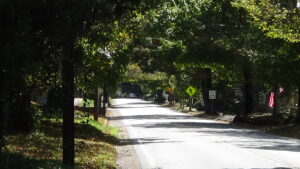
Go north across the road coming from the Visitor Center, into the historic heart of town. Walk up the rock sidewalk leading you past the front of the house on the corner. Take the first crosswalk to the left across Main Street, turn right, and walk up the street.
The first alley marks the edge of what originally was the town square. By the time of the Revolution, the layout of the homes and church had shifted to what you see today. None of the homes on this side of Main south of the alley existed yet. (Several on the other side did by 1800, and might have by wartime.[1])
Continue to Jan Hus Lane, the next road on the left.
The house across the lane exists when Cornwallis is here, built in 1775. Officers and their servants crowd into the few homes like this one, a log cabin at the time.
Across the street at that time, where Bethania Moravian Church now stands, is the second wooden Gemain Haus (ge-MINE-house) or “Community Hall,” a combination church, meeting hall, and community center built in 1770.
Continue to 5570 Main.
The current house “only” dates to around 1808. During the Revolution this lot was the site of a schoolhouse, possibly the first one given its location. The Records say that all of the children, and probably the unmarried female teens, are moved to “the schoolhouse” for protection from the soldiers. No doubt they spend a sleepless night under the care of several mothers.
Walk to the end of the block at Loesch Lane. The last house on the left was a log cabin built in 1775. The empty lot across the lane is where the pre-1765 tavern stood, which was ransacked overnight by thirsty soldiers.
Cornwallis Demands Horses
Look across the street at 5575 Main, from around 1770.
 This is the house where Cornwallis stayed, owned by George Hauser, Jr.[a] A blacksmith like his father, Hauser defied Moravian neutrality to join the state militia. He was a lieutenant in the 1776 campaign against the Cherokees, and helped guard Loyalist prisoners from the 1780 Battle of King’s Mountain (S.C.) when those arrived in this area. A slaveholder, post-war he served in the General Assembly and the state convention that agreed to the new U.S. Constitution.[b]
In 1781, Redcoat guards are in front, and couriers move in and out. From inside Cornwallis sends demands to the leaders of the town. The army is desperate for supplies. The Records report that an “order was given that cattle for butchering should be furnished, and as that was neglected more than sixty were killed during the day, of which about thirty were seized here; this did not include the sheep, geese and chickens which they took. Two wagons were sent to the mill for meal, and scarcely had they left when a sharp order was given, with, threatened penalty for non-execution, for twenty good horses to be ready by six o’clock. Everything was in the greatest confusion and no one knew what to do, for all houses were filled with officers and their servants. At dusk a second written order was received, saying that the horses must be forthcoming by six o’clock, with repetition of the threats.”
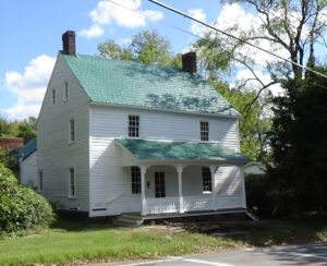
The town leaders come here to the house. “Between eight and nine o’clock we made an attempt to explain to General Cornwallis that it was impossible to furnish twenty horses; he was not at all moved, but wrote a Pass permitting two of our young men to ride to the neighbors and bring in some horses.”
The unknown writer of the town diary added, “I had hardly reached the house when an officer arrived to seize me as hostage until the horses were furnished, but the officers lodging with me interfered, and he went away without me.”
An Exit Near the Final Resting Place
Return to the church and cross Main Street. Walk up Grabs Drive beside the church to the trail on its right going to the cemetery, “God’s Acre.”
Given Cornwallis’s lodgings and our next stop, this hill was almost certainly part of the British camp.
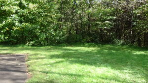
Turn right and then left on the paved driveway around the cemetery. At the last parking space, walk off the pavement to the right ahead of you. Though unmarked, an unpaved foot-trail near the corner of the woods should become obvious when you get close.
Take the trail to the sign at the junction with the Graveyard Trail, and turn left. Where the woods open onto a meadow, take the cleared trail to the right and then left. Where it turns left yet again (making a loop), continue straight into the woods.
 Where the trail drops down sharply, you are standing on the road taken out of town by the army at 7 a.m. the next morning. They are headed for Salem via Bethabara and points south, continuing their pursuit of Greene. It would have taken hours for the last of them to leave.
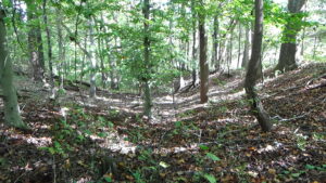
They have only 17 new horses—and not even that many: “at least six of these had been taken secretly from the English teamsters,” the diary reports! The residents are glad that “none of us was injured in soul or body, though in cattle, grain, hay, brandy and fences we have lost as much as £1500, valued in good money.” That’s roughly $275,000 modern dollars, a big hit for a small town.[2]
You can return the way you came. Or take a more direct route to the Visitor Center by walking roughly a quarter-mile past the junction near the cemetery. The Graveyard Trail comes out behind a former mill. Keep straight ahead along its covered driveway to the road and turn right. You’ll see the center on the left.
Historical Tidbits
- Bethania was founded as a farming community for the Wachovia district. Unlike the first settlement at Bethabara, three miles away, its layout was carefully planned. Moravian leaders patterned it after German models with commonly owned forests and farms. They pounded the pegs for the central lots and streets you still see today on Friday, June 30, 1759. Main Street was first cut 10 days later.[3]
- Bethania remains the only town with this pattern in the South. Unlike the other original Wachovia villages, it is still an independent city with a large Moravian population.
More Information
- Crews, Daniel, ed., Bethania: A Fresh Look at Its Birth (Winston-Salem, NC: Moravian Archives, 1993) <https://www.moravianarchives.org/wp-content/uploads/2015/06/Bethania-booklet.pdf> [accessed 10 October 2020]
- Fries, Adelaide L., ed., Records of the Moravians in North Carolina. Volume IV: 1780-1783 (Raleigh, N.C.: Edwards & Broughton, 1930), 4 (1780-1783) <http://archive.org/details/recordsofthemora04frie> [accessed 19 March 2020]
- Fries, Adelaide L., Wright, Stuart, and J. Edwin Hendricks, Forsyth: The History of a County on the March (Chapel Hill: The University of North Carolina Press, 1976)
- ‘George Hauser Jr. (1755-1818)’, WikiTree FREE Family Tree <https://www.wikitree.com/wiki/Hauser-375> [accessed 7 February 2022]
- ‘History’, Town of Bethania <http://townofbethania.org/history/> [accessed 30 April 2020]
- ‘Johann Georg Hauser (1730-1801)’, WikiTree FREE Family Tree <https://www.wikitree.com/wiki/Hauser-187> [accessed 7 February 2022]
- Jones, Randell, Before They Were Heroes at King’s Mountain, North Carolina/Tennessee Edition (Winston-Salem, NC: Daniel Boone Footsteps, 2011)
- Lewis, J. D., ‘Bethabara, North Carolina’, Carolana, 2007 <https://www.carolana.com/NC/Towns/Bethabara_NC.html> [accessed 24 April 2020]
- Williams, Michele, Town of Bethania, In-person interview, 10/3/2020
[1] Williams 2020.
[2] Nye, Eric, ‘Currency Converter, Pounds Sterling to Dollars, 1264 to Present’ <https://www.uwyo.edu/numimage/currency.htm>.
[3] Crews 1993.
[a] Fries, et al. 1976.
[b] “George Hauser Jr.…”
← Shallow Ford | Wachovia Tour | Bethabara →
