
Location
Other maps: Google, MapQuest.
Coordinates: 35.1057, -75.9863.
Type: Sight
Tour: Cape Fear
County: Hyde
![]() Difficult
Difficult
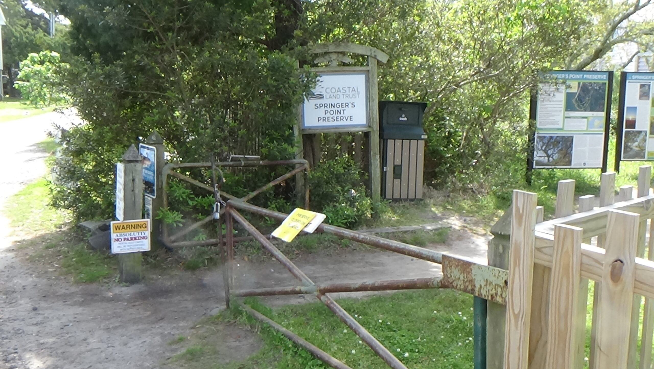
The trail into Springers Point Preserve at the coordinates takes you a quarter-mile to the former site of Pilot Town. Nearby Lighthouse Road has several free parking options. Walk to the end of that road, turn left onto Loop Road, and you will come to the trail farther down on the right.
The second part of the trail is sandy, narrow, and root-crossed, not suitable for wheelchairs.
Context
The British government is trying to block military and other supplies from getting to rebel colonies in America.
Situation
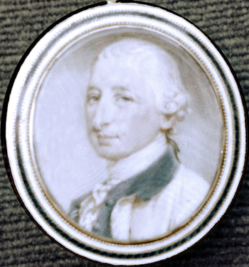
British/Loyalist
The unique shape of the North Carolina coast poses problems. A long line of thin barrier islands now called the “Outer Banks” are cut by “inlets” that change in location and depth. Without help from local pilots who know where the current shoals (shallows) are, British ships hesitate to go through. This often leaves them on the ocean side guessing where the merchants will appear. Meanwhile, they have to land raiding parties on the islands at times to get food and fresh water.
Continental/Patriot
While merchant ships play hide-and-seek with blockaders, government-backed pirates called “privateers” and the tiny North Carolina Navy try to protect them and capture British ships. Part-time “militia” soldiers oppose the British raids on land and sometimes surprise vessels, as do Patriot pilots.
Date
Sunday, April 14, 1776.
Timeline

Imagine the Scene
Crossing the Bar
Take the trail. When you reach a junction marked with arrows, stay right to follow the blue one. At a small graveyard, go left, and soon you will come to the shore.
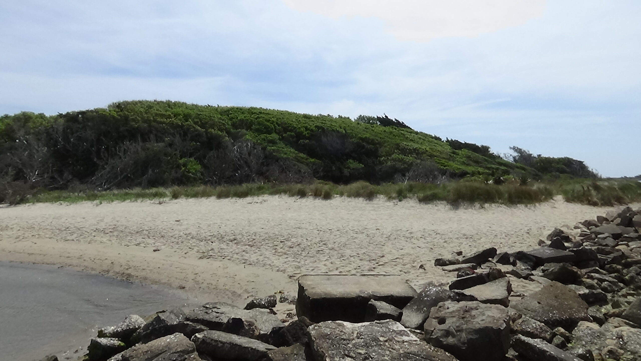
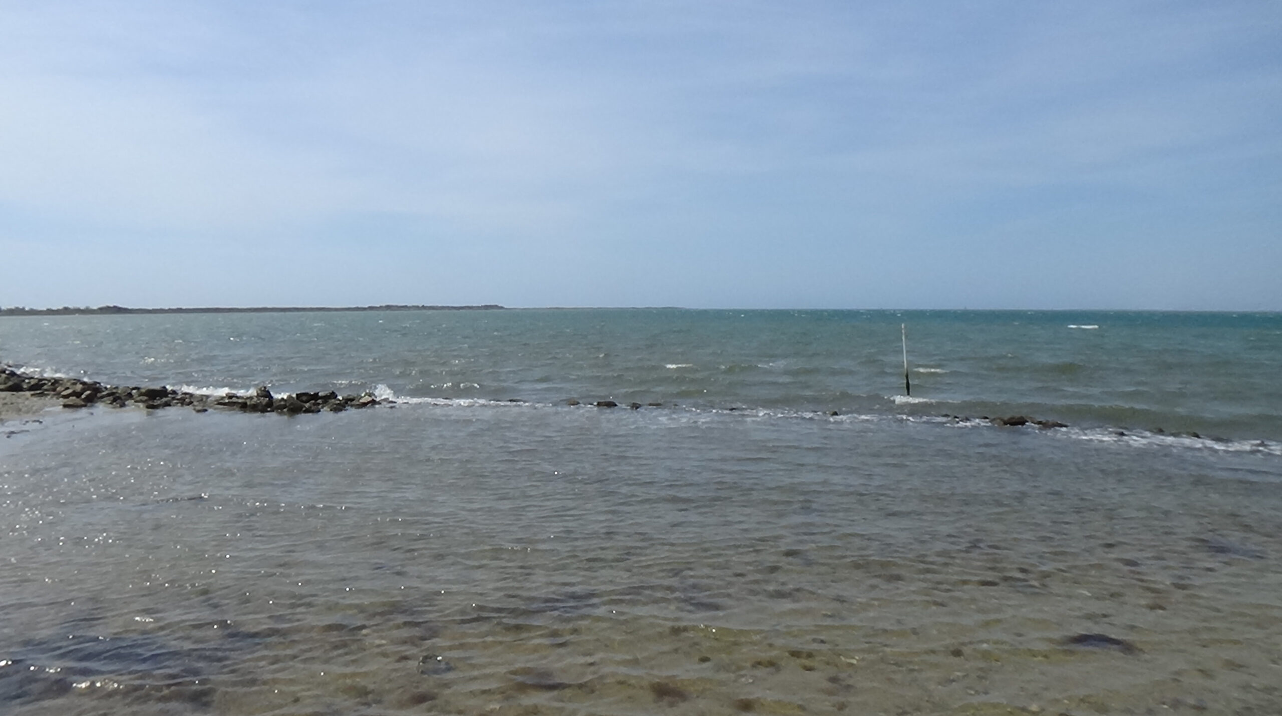
Ahead of you is what would have been considered Ocracoke Bay in 1776, according to a local historian, and you are standing in Pilot Town.1 With your eyes, trace the finger of island to your left to its end; the water beyond is Ocracoke Inlet, and Portsmouth Island is on the other side. The Atlantic Ocean is to your left (east), and Pamlico Sound to your right.
For a better view of Springer’s Point, take the small trail on the right to the jetty of rocks, and turn around where you can see both the trees and the inlet.
Ocracoke has long been important to residents of today’s North Carolina. Native Americans used the island as temporary fishing grounds; the name is a corruption of the name Woccocock or Woccocon.2 The flagship of Sir Walter Raleigh, leading the first English colonists in today’s United States toward Roanoke Island, ran aground here in June 1585. Cargo was removed and the ship beached for repairs before continuing.3
In the 1600s a system developed in which smaller ships (“lighters”) waited here for those too heavy to get through the inlet. These would transfer goods to and from the port towns on the mainland, such as Bath, Edenton, and New Bern. Settlers began arriving around 1700, bringing livestock that thrived on the local greenery or seaweed, fishing, and growing vegetables. Portsmouth was founded across the inlet in 1753, to make lightering easier, service ships, and house the mostly enslaved workers. As you stand here in 1776, it has around eight buildings, including a church.4
When the British succeed at blocking off Chesapeake Bay and ports in the North, Ocracoke becomes a primary route of military and civilian supplies for the new United States and Gen. George Washington’s army. Lighters take them up the Chowan River by Edenton to South Quay, Va., from which goods are moved north by land and rivers.
Getting a ship over the “bar” of sand at the bottom of the inlet was difficult because the shape changed constantly.5 “Pilots” watched for seagoing vessels to arrive. They then rowed out to guide the ships across, and sometimes onward into the inland ports. The state set aside 20 acres for them here in 1766. Why is unclear, since Portsmouth already had pilots. Possibly what was first called Pilot Town was for African-American pilots, some of them enslaved. Soon referred to as Ocracoke instead, it centered on today’s Springers Point. There is no record of what structures you could see here: houses, at least, and possibly a tower to watch for arriving ships.6 By the end of the war around 75 people live here.7
British gunships and privateers began to capture merchant ships bringing in military and other critical goods, or exports to pay for those imports. Salt is often mentioned in reports from the war, because in those days before tin cans and refrigerators, it was the main way to preserve food. The state produced only a small fraction of what people needed.
Those blockaders and raiders needed food and fresh water. A committee of the rebel Provincial Congress reported in Spring 1776 that “all the sea banks are covered with cattle, sheep, and hogs,” which made up the wealth of most inhabitants. The state authorized five militia companies to operate on the Outer Banks, both to defend residents and to capture British ships at anchor.8 The company based here bought three boats large enough to do that.
Tensions arose with the pilots, who were paid less, so the militia company was disbanded a year later. Its captain objected without success, knowing what would happen. By November 1778, a General Assembly member wrote, “‘The coast is much infested at this time with the enemy which are constantly landing and plundering.’”9 In time a smaller militia company was recreated, and after the pilots went on strike for equal treatment, they were added as members.10
After all, the pilots had already proved themselves worthy defenders of Ocracoke.
The Polly is Lost and Found
Around 4 p.m. on Sunday, April 14, 1776, a ship named the Lilly passes over the bar. No pilots row out, because they know its Virginia captain knows these waters. Sources differ on whether the Polly, an Edenton merchant ship, is already at anchor in the bay or comes in soon after. Regardless, the captain of the larger Lilly, John Goodrich, orders the Polly’s Capt. Silas Henry to come over with his cargo papers—which makes no sense, because both are American ships. But the Lilly has cannons, so Henry complies, joined by the Polly’s half-owner. Once they arrive, Goodrich informs them their ship is now his “prize”: Goodrich has joined the British! His sailors return the pair to the Polly and disarm its crew.
Around sundown a larger British warship, the HMS Fincastle, comes through the inlet without a pilot. The Lilly has been serving as its tender (supply ship). Not aware the Lilly has already captured the Polly, the Fincastle’s Lt. John Wright leads a small raiding party to it. These “‘plundered the said schooner of all the live stock… and left a prize master and four armed men onboard.’”11
Most of the Lilly’s crew members are sent to the Polly. For two days the winds and tides prevent departure, but then the Fincastle weighs anchor and goes out the inlet. The pilots have been watching. They arm themselves, and in the pre-dawn darkness 23 led by Benjamin Bonner leave here in five boats with muffled oars (wrapped in cloth to reduce noise).12 One source says Goodrich hears them as they approach the Lilly, but can’t awaken his men before a pilot is pointing a gun in his face.13 They capture the ship.
Some of the men row on to reclaim the Polly and grab the rest of the British crew. Those men and the two ships are sailed to New Bern. There a court orders the vessels and cargo sold, the Polly’s owners getting two-thirds of the money and the pilots splitting the rest.
Buoyed by this success, later that month the pilots go after another small British ship. They take it, “‘1,000 pounds of gunpowder, and sixteen men.’”14
Goodrich and others were taken to the Halifax jail. The court there decides he is a prisoner of war, so he isn’t hung for treason. He and the other men escape, though. Goodrich returns to privateering—or pirating, given that he took a Loyalist ship, too! He and his sons were captured and escaped multiple times, always returning to sea. He is named repeatedly in reports from the N.C. coast throughout the war. Afterwards he bragged that he bagged 50 prizes in his career. The family went to England after the war and returned to legal commerce.15
A Tory Plotter and Privateers
In the summer of 1777, Ocracoke plays a tiny part in one of the most bizarre stories of the Revolution in North Carolina, a Loyalist or “Tory” plot now called the Gourd Patch Affair. At least a hundred Tories in the northeast part of the state were recruited via secret signs and codes. The goal was to capture the governor and create a state government that supported the King and the Church of England.
After it unravels, one of its leaders, William Brimage, tries to flee through the inlet. He is captured by the militia and apparently brought here. (The early state records rarely mention Portsmouth, N.C., so people might have used “Ocracoke” to refer to both towns.) Brimage escapes with two other men, and convinces two boys to row them north. After the boys figure out something is wrong, a storm helps them get away and return. Brimage is eventually caught.
That winter, one or several ships of the tiny North Carolina Navy make rounds here. The last royal governor of N.C., Josiah Martin, is with the British in New York, but he keeps tabs on his old post. He writes a London official in January 1778 that “the contemptible port of Ocracock has become a great channel of supply to the rebels, while the more considerable ports have been watched by the King’s ships. They have received through it considerable importations.”16
Also that year a Loyalist wrote “‘there is an amazing quantity of goods brought into North Carolina, and… Virginia and Maryland are supplied from that quarter.’”17
On Saturday, April 4, 1778, a single-masted “sloop” with sails fore and aft arrives at the bar, the North Carolina Gazette newspaper reports. The pilots recognize it, as it has gone out recently, and two or more row out. Unfortunately, onboard they get bad news: The sloop has been captured, and now is a British privateer. The captain is after a large French ship here in the harbor, and a brig with a lot of tobacco. Even then tobacco is a major export from North Carolina, important to the war effort because it can be sold or traded for supplies. The captain tells the pilots if they do not guide him across the bar, he will “instantly put them to death.” They wisely do so.
As the privateer’s prize master testifies later, “We manned the pilot Boat and rowed over, and went on board the (French) ship, and took possession of her.”
The privateer also claims another merchant sloop. “Thus has a small sloop with 4 guns and 30 men robbed this state of two fine vessels with more than 100 hogsheads (barrels) of tobacco and a considerable quantity of salt,” the Gazette reports. However, the privateer runs aground and is taken. At least four men are captured, too, including the prize master.
The next month, the N.C. Navy’s row galley Caswell arrives in the bay. It’s basically a two-deck rowboat aided by a small sail, 75 feet long, with 16 cannons and a crew of 170 including Marines. She has the desired impact. In another month, Capt. Willis Wilson reports, “the enemy (one ship, two sloops, and a brig) take a peep at us every now and then, but are not disposed to venture in” through the inlet.18
He was not impressed with the pilots. He writes the N.C. governor for whom his ship is named, Richard Caswell, that a French ship is outside the bar eager to come in, its captain fearful of capture. But Wilson cannot get a pilot to go out. “This is not the first instance by many of the rascality of those men; every merchantman coming to this place experiences it, and it’s clearly evident to me that they wish every vessel cast away (wrecked), as they may plunder them.”19 This seems an angry exaggeration, given the massive amount of goods known to have passed through the inlet successfully.
His ship is off on another mission in September 1779 when the British warship H.M.S. Lord Howe, a brigantine or “brig” with two masts and square sails, appears with two smaller ships outside the inlet. These bottle up a growing number of ships in the harbor before the British finally make it across the bar. Many of the merchants flee over Pamlico Sound to the rivers, but “‘a large French brig’” and others are captured in front of you.
The Caswell returns at some point, but Wilson fails to keep his galley ship-shape. Within a year it sinks in the harbor or nearby, “‘her bottom… eaten out’” by worms so badly it could not be rebuilt.20
Historical Tidbit
In 1756, during the French & Indian War, the state built a fort at the near tip of Portsmouth Island. It had an earthen rampart with a wall made of bundles of sticks, and gaps for cannons facing the inlet. It never saw action, and was abandoned within two years, which was a mistake. A fort would have been useful during the Revolution, and in the War of 1812, Portsmouth and Ocracoke were occupied and plundered for five days by British troops.
In 1824, two-thirds of the state’s goods passed through Ocracoke Inlet, and over the next 20 years around 1,500 ships came through each year.21 The state made Portsmouth a site for inspecting and taxing cargos, building a Custom House for that purpose. The town eventually had a school, hospital, and several taverns. In 1850 there were 500 people and 70 houses.
When a storm opened Hatteras Inlet to the north, this began a slow decline for Portsmouth. The choice to rely on forced laborers came back to haunt residents when slavery was abolished after the Civil War, and many residents left. The U.S. Life Saving Service, a precursor of today’s Coast Guard, put a station at Portsmouth in 1894. Among other rescues, it famously saved 400 people from a wrecked Portuguese ship, aided by locals. The station closed after 30 years, reopening briefly to watch for threats during World War II. The post office died in 1959, and the last permanent citizens left in 1971. The National Park Service now maintains the site, which you can arrange to visit by boat.22

More Information
- Adams, John, ‘Deposition of John Adams Concerning Actions of Privateer, Volume 13, Pages 95-96’, Documenting the American South: Colonial and State Records of North Carolina, 18 April 1778 <https://docsouth.unc.edu/csr/index.php/document/csr13-0122> [accessed 26 November 2025]
- Ballance, Alton, Ocracokers (The University of North Carolina Press, 1989)
- Burke, Jr., Kenneth E., ‘The History of Portsmouth, North Carolina, from Its Founding in 1753 to Its Evacuation in the Face of Federal Forces in 1861’ (unpublished Master’s Thesis, University of Richmond, n.d.), Charlotte Mecklenburg Library
- Collet, John, ‘A Compleat Map of North-Carolina from an Actual Survey’, North Carolina Maps:, 1770 <https://web.lib.unc.edu/nc-maps/interactive/CK272.php> [accessed 9 May 2026]
- Crow, Jeffrey J., Report on the Battle of Beaufort, 1782 (Division of Archives and History, State of North Carolina, 1976)
- Day, Jean, Revolutionary Patriots Along the North Carolina Coast, ed. by Hervie Day (Golden Age Press, 2006)
- Delaney, Norman C., ‘The Outer Banks of North Carolina during the Revolutionary War’, North Carolina Historical Review, XXXVI.1 (1959)
- Dunbar, Gary S., Historical Geography of the North Carolina Outer Banks, 1958, Davis 5 <https://catalog.lib.unc.edu/trln/UNCb1470524> [accessed 5 May 20What AI 26]
- Goerch, Carl, Ocracoke (Edwards & Broughton Company, 1956), ECU Digital Collections <https://digital.lib.ecu.edu/16976> [accessed 5 May 2026]
- Holland, F. Ross, A Survey History of Cape Lookout National Seashore (National Park Service, U.S. Dept. of the Interior, 1968), History Museum of Carteret County, Vertical Files, ‘Ocracoke, History of’
- Howard, Philip, ‘Ocracoke Locations’, In-person interview (Ocracoke, N.C.), 16 April 2026
- Leah, Heather, Lost Towns of North Carolina (The History Press, 2026)
- Lewis, J. D., ‘Ocracoke Inlet’, The American Revolution in North Carolina, 2009 <https://www.carolana.com/NC/Revolution/revolution_ocracoke_inlet_1.html> [accessed 18 May 2026]
- Lupton, Richard, Olde Wickham, Little Kingdom by the Sea: A Comprehensive History of Hyde County, Including Ocracoke and Hatteras (Edwards Brothers Malloy, Inc., 2017)
- Mouzon and Others, Henry, ‘An Accurate Map of North and South Carolina’, ECU Digital Collections, 1775 <https://digital.lib.ecu.edu/1029> [accessed 9 May 2026]
- National Park Service, U.S. Dept. of the Interior, ‘History of Portsmouth Island’, ArcGIS StoryMaps, 25 February 2024 <https://storymaps.arcgis.com/stories/c4355b5789ac459d992df3519d369713> [accessed 28 April 2026]
- ‘New Bern, April 10’, The North-Carolina Gazette. (Newbern, N.C.), no. 1778/04/10 (April 1778), p. 3 <https://newspapers.digitalnc.org/lccn/sn84026629/1778-04-10/ed-1/seq-3/> [accessed 28 November 2025]
- O’Neal, Calvin J., Alice K. Rondthaler, and Anita Fletcher, ‘Revolutionary Period’, Ocracoke Preservation Society, n.d. <https://www.ocracokepreservationsociety.org/ocracoke-history/revolutionary-period> [accessed 13 April 2026]
- O’Neal, Calvin J., Alice K. Rondthaler, and Anita Fletcher, The Story of Ocracoke Island: A Hyde County Bicentennial Project (n.d.), Ocracoke Preservation Society
- Paullin, Charles Oscar, ‘The Navy of the American Revolution: Its Administration, Its Policy and Its Achievements’ (unpublished Doctoral Thesis, The University of Chicago, published by The Burrows Brothers Co., 1906) <http://archive.org/details/navyofamericanre00paul> [accessed 6 November 2025]
- Shears, David, Ocracoke: Its History and People (Starfish Press, 1992)
- Smith, Robert K., with Earl O’Neal Jr., The History of Fort Ocracoke in Pamlico Sound, Civil War Series (Arcadia Publishing Inc, 2015)
- Stick, David, The Outer Banks of North Carolina, 1584-1958 (The University of North Carolina Press, 1958)
- ‘Timeline of Portsmouth’, The Mailboat (Harkers Island, N.C.), 3.1 (1992)
- Wilson, Willis, ‘Letter from Willis Wilson to Richard Caswell, Volume 13, Pages 132-134’, Documenting the American South: Colonial and State Records of North Carolina, 20 May 1778 <https://www.docsouth.unc.edu/csr/index.php/document/csr13-0168> [accessed 5 May 2026]
1 Howard 2026.
2 Delaney 1959.
3 This group was unsuccessful and is known as the “Lost Colony.”
4 Based on two maps from the 1770s (Collet 1770 and Mouzon 1775). The fact no structures are shown on Ocracoke adds to the idea segregation was the reason for Pilot Town (see below in the text), so the norms of the day prevented its inclusion.
5 Delaney.
6 Location and structures: Howard.
7 Ballance 1989.
8 Delaney.
9 Quoted in Crow 1976.
10 Day 2006.
11 Quoted in Stick 1958.
12 Number and leader from a letter published in the Pennsylvania Gazette on 5/8/1776, quoted in Smith 2015.
13 Stick.
14 Quoted in Stick.
15 Day.
16 Quoted in Paullin 1906.
17 Quoted in Crow.
18 Quoted in Paullin.
19 Wilson 1778. Punctuation updated slightly for clarity.
20 Gov. Thomas Jefferson of Virginia in a letter to Gov. Caswell, 6/22/1779, quoted in multiple sources. The Caswell was jointly built by the two states.
21 Smith.
22 Summarized from National Park Service (2024), supplemented from Leah (2026) and other sources.