

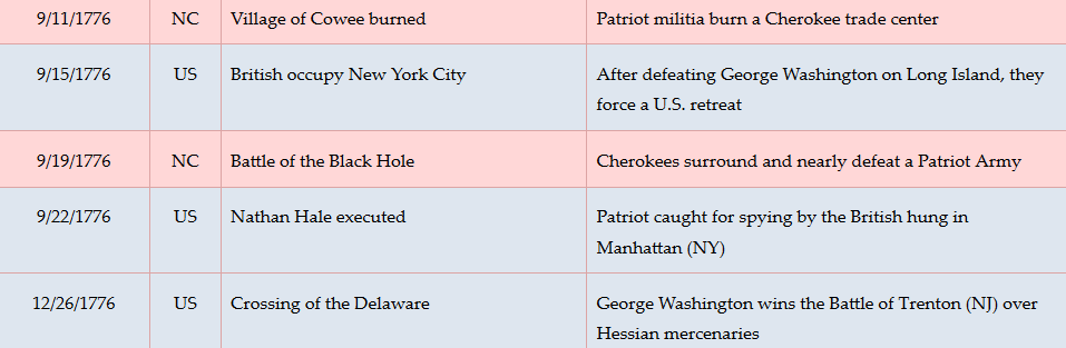
Context
 Cherokees retaliated for continuing incursions on their lands with a series of attacks over the Summer of 1776, so commanders from the Carolinas and Virginia launched coordinated campaigns to destroy their towns.
Situation
Cherokee
Knowing they could not defend the villages one at a time, warriors evacuated their families, and many joined in a plan to ambush the militia. Hundreds gathered at a narrow valley that was part of the main route deeper into the mountains over Wayah Gap.
Militia
South Carolina militia Col. Andrew Williamson, with 1,696 soldiers including some Catawbas, tried to join up with a North Carolina force under Brig. Gen. Griffith Rutherford.[a] They missed each other at Nĭkwăsĭ´ (modern Franklin). Rutherford headed southwest to attack more villages. He probably intended to use Wayah Gap, but missed the turn, so Williamson likely thinks he is following Rutherford. His troops camped overnight in a village he calls Canucca six miles east, at modern Parker Meadows Park.[b] They leave early in the morning and head for the gap.
Date
Thursday, September 19, 1776.
Timeline
Imagine the Scene
Surrounded by Hidden Foes
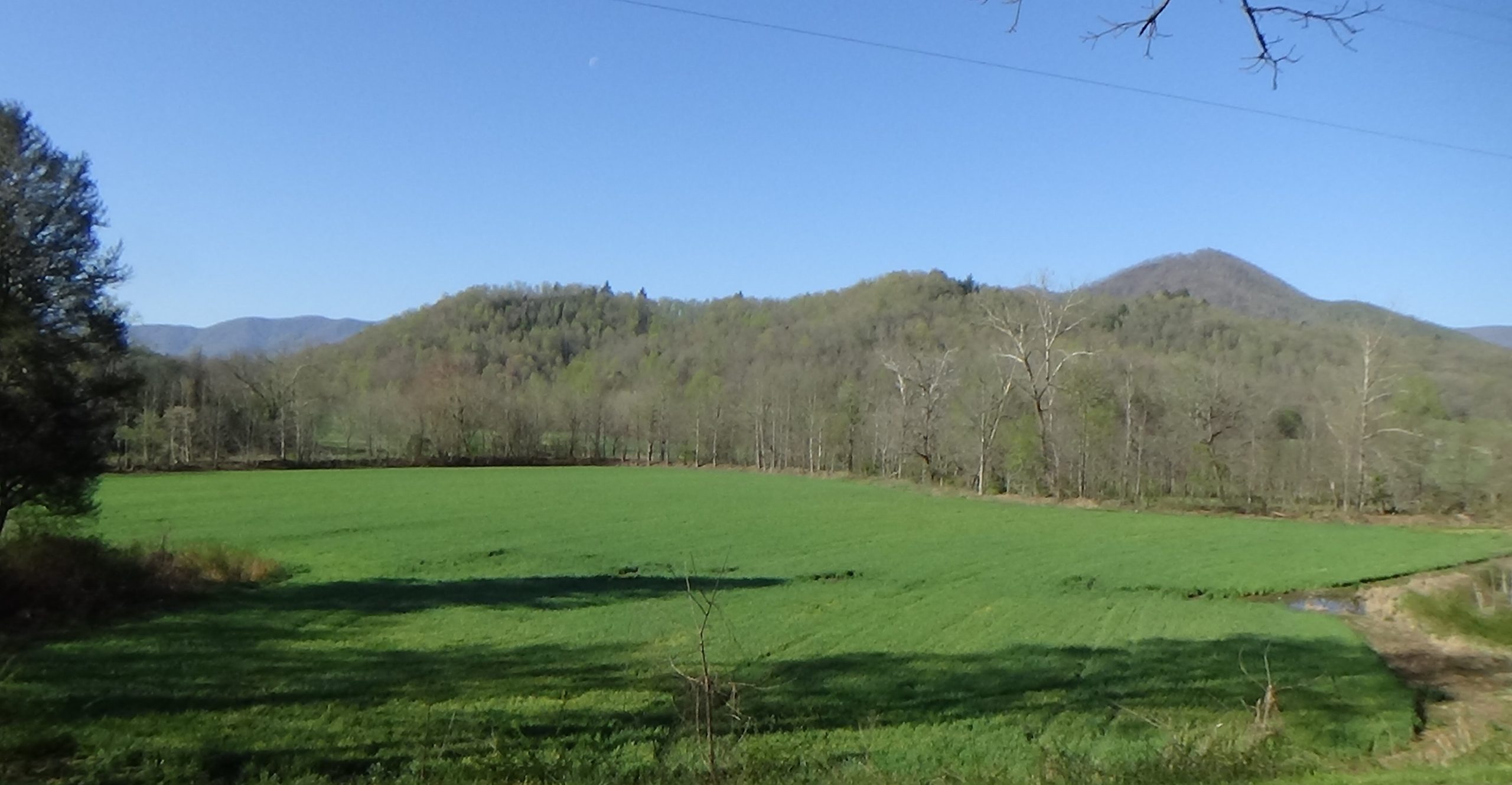
The exact location of this battle has not been confirmed by archaeologists. However, a review of all eyewitness accounts, test of the mileages one offers, and the topography, suggest this cove as the best candidate for the site of an ambush on the front of the militia column.[c]
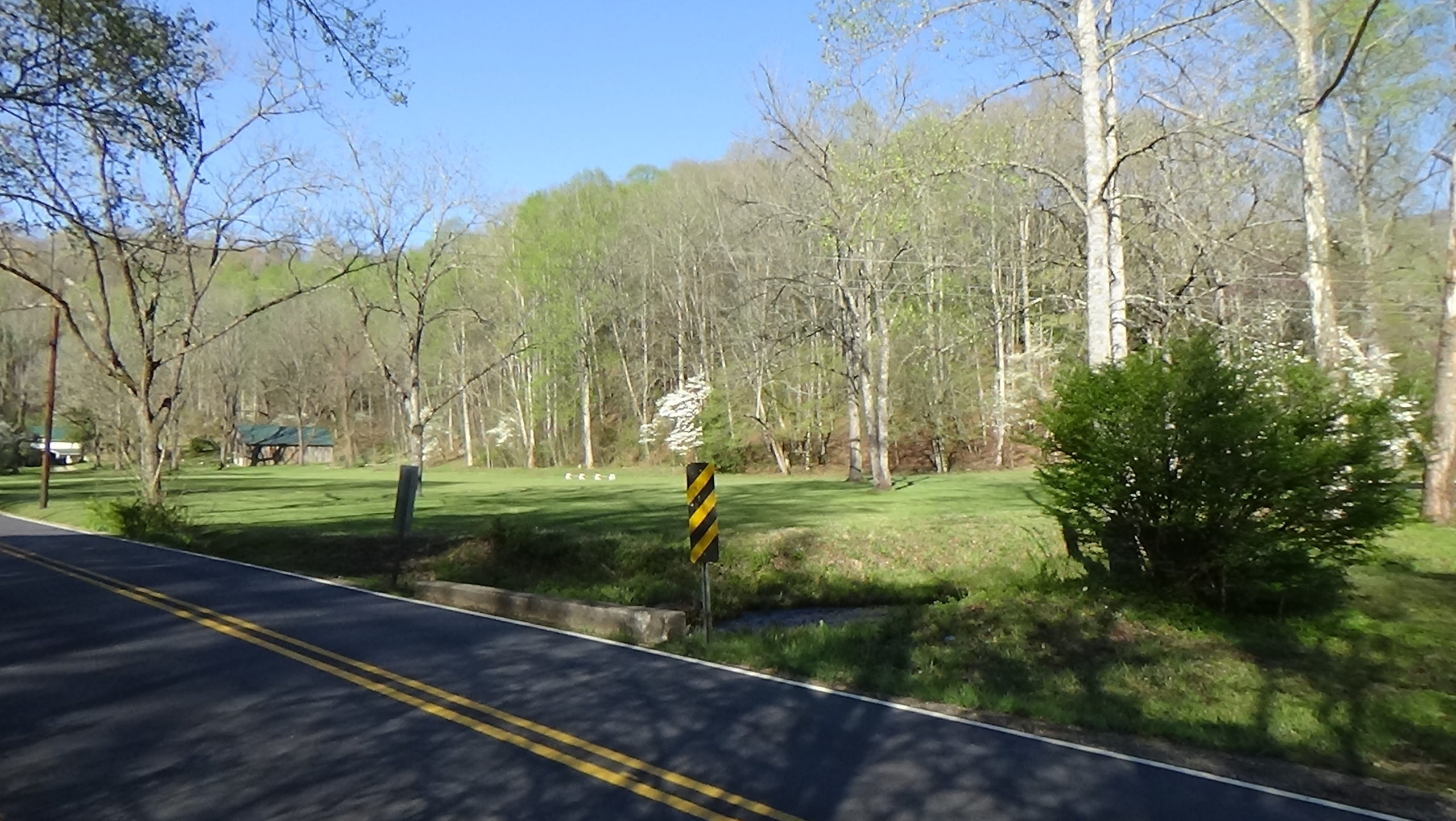
Look to the left along Wayah Road (toward Franklin).
In 1776 there is a Native American trail where the road runs today. You see Patriot militiamen make their way slowly toward you up the valley on horseback, probably in pairs side-by-side.[1] The militia wear standard backwoods clothing, not uniforms, and carry long guns, hatchets, knives, and perhaps some swords. Each pair likely stays close to the one ahead of them, because troops have found signs of Cherokees in the area. Still, the line may stretch almost two miles. As you watch, the front or “vanguard” of the army probably rides into this cove. Militiaman Arthur Fairies wrote, “‘we marched into a valley or rather a hollow, named Black Hole, surrounded by mountains on all sides only except the entrance.’”[2]
Look around the cove.
It is roughly 10:30 in the morning. Suddenly guns blaze from the woods in front of you, and men fall. “In an instant in front, in rear, on the right and the left, the warwhoop sounded,” soldier Joseph McJunkin wrote. “The warwhoop was answered by a shout of defiance, and the rifles of the Indians answered by an aim equally deadly.”[d] As far as you can see in each direction, Cherokees hidden in the trees on both sides of the valley are marked by their muzzle blasts. The militia likely dismount, take cover as best they can, and begin shooting back.
Fairies wrote, “‘the Indians were flanked all around us, and fired on our guard, and all our regiment was soon engaged, & the firing of the Indians incessant.’”
The militia find themselves shooting in all directions. You also hear a continuous din of gun reports reverberating up the valley as the rest of the army defends itself. The militia get increasingly desperate as smoke fills the area, further obscuring their attackers.
A number of the Cherokees maneuver to the lower slopes, eager for the hand-to-hand combat with war clubs preferred in their culture, because it is considered more courageous.[3] As they emerge you see they are in traditional battle dress: loin clothes and red body paint, accented by different shapes in black on the face and body—the color of death.[4] “It was not only a woodsman’s fight from tree to tree,” McJunkin says, “but often from hand to hand.”
Capt. Francis Ross, 41, finds himself in a vicious fight alongside the vanguard. A gunshot drops him with a slight but bloody head wound. Fairies wrote, “‘the Indians thought to have his scalp and… struck him with the gun in his hand, until the force of the strokes broke the butt piece; but the Captain recovering, seized the fellow and overcame him getting his scalp.’”[5]
Fierce Fighting Fizzles
Turn left on Wayah Road and drive 0.6 miles to the Lyndon B. Johnson Job Corps Training Center. Pull into the blocked off driveway on the right prior to the main entrance.
The Cherokees hide in tall grass on open parts of the hillsides. One source suggests the militia does not stop to fire initially as they charge, because reloading would be difficult on the slopes, while exposing them to the Cherokee guns.[e] An N.C. soldier heard later that the S.C. troops also fire swivel guns—tiny cannons mounted on rods—at the hidden enemy.[f]

It’s unclear where the Cherokee lines ended, but math suggests it could have been around here.[g] Regardless, the militia column stretched beyond it. Soldiers try to push up the mountainsides in both directions. Whether the warriors are driven off, or begin running out of ammunition, eventually they retire up-slope. After one or two hours, the heavy fire dies away as the warriors pull over the mountaintops.
At least four of the Cherokees remain behind dead, while an unknown number of casualties were taken away to prevent scalping by the militia. Fairies says one of the warriors “was afterward discovered to be a woman, painted and armed like a warrior.”
After the Battle
Fairies declared the battlefield, “‘A most dreadful sight to behold.’”[6] He says the Cherokees “left baggage of about two hundred of them, that is to say, blankets, moccasins, boots, some guns, matchcoats, deer-skins,” and more. The militia camped there overnight, “burying our dead and attending the sick and wounded.” Among the dead were “three or four scalped and one sadly speared and tomahawked.”
Fairies says the sick and wounded were sent back to Canucca with 100 men as guards the next day. The force Rutherford left there heard the sounds of the battle and sent 200 men this way, who presumably ran into them.[h]
The S.C. army marched on, continuing on the trail up the route now followed by Wayah Road to Wayah Gap, through “‘immense numbers of Indian camps,’” Fairies says, presumably those of their attackers.
From there they wended down through more camps the next day. On spotting a Cherokee woman, according to Fairies, a couple of men shot and wounded her. She told them that all of the Overhill men from modern Tennessee, and most of the Middle Town warriors from this side of the mountains, a total of 500–600, had been at the Black Hole. The Cherokee fighters regrouped and were awaiting them at the Nantahala River (now Lake), she said. She was badly wounded, so they killed her, supposedly as an act of mercy. The army made its way over and along the mountains to the Valley River and went south down it destroying villages over several days. Eventually it met up with Rutherford’s army east of modern Murphy before heading home.[i]
Ten days later, on Sunday the 29th, the North Carolinians pass this way from the gap downhill as they head home. Lt. William Lenoir reported, “we marched by ware (sic) the South army fought the Battle saw the Dead Indians lying…” The militia dead were “buried in the swamps and a pole causeway made, over which we marched.”[7]
This was the last direct confrontation between massed Cherokees and militia in modern North Carolina. Raids by both sides continued for years, and more open battles occurred across the mountains.
For a wonderful view of the surrounding mountains, drive 5.2 miles uphill from the first stop to the crest at Wayah Gap, following the South Carolina army. (Around 2.9 miles, after a sharp curve left, you will see the state historical marker about this battle on the right. There is a long pullout across the road if you wish to read it.) At the gap, take the Forest Service road to the right. A 4.4-mile drive, on a sometimes bumpy dirt road, takes you to a parking lot just past the observation tower on Wayah Bald. For those with mobility issues, a patio at the tower is fully accessible using a paved trail from adjacent parking.
Battle Map

The Battle of the Black Hole: All locations except the trail route are approximate; “X” marks each tour stop. 1) S.C. militia march up trail to Wayah Gap as Cherokees await. 2) Vanguard is ambushed, becomes surrounded; hand-to-hand combat occurs. 3) Both sides fire all along the lines, and soldiers try to move up the slopes. 4) Cherokees withdraw as ammunition runs out.
Casualties
 Cherokee: 4-16 or more killed and 8 wounded, 0-13 captured.
- Militia: 9-17 killed (including 1 Catawba), 18-31 wounded (2 Catawba).
Historical Tidbits
- “Wayah” comes from the Cherokee word for “wolf,” but the Cherokees called the gap “A’tahi’ta,” meaning “Place Where They Shouted.” A tribal story said a giant yellow jacket wasp named U’lagu’ would take children from Briertown on the Nantahala River. So the residents put out a deer with a “long white string” attached. When U’lagu’ took it, flying off slowly because of the weight, hunters tracked it to the gap. From there they saw where its nesting cave was, on this side, shouting in excitement. Smoke from fires they built in the opening killed U’lagu’ and the regular yellow jackets inside. Others were not in the cave, so to this day upset yellow jackets inhabit the area’s woods!
- The Cherokees eventually made peace with the Americans, and many adopted European-American ways. Despite this, they were forced by the U.S. Government to move to modern Oklahoma in 1838, on what is called the “Trail of Tears.” A white man named William Siler bought land along Cartoogeechay Creek for Cherokee friends to live there, thus avoiding removal. It was off the north side of US 64 as it crosses the creek today, just west of where the highway becomes a two-lane road, south of here. After the current Qualla Boundary reservation was created for other Cherokees who had escaped removal, most of these “Sand Town Cherokees” moved there.[j]


More Information
- Beadle, Michael, ‘Rutherford Trace: Local Historians Examine the Legacy of a Shock-and-Awe Revolutionary War Campaign against the Cherokee’, Smoky Mountain News, 2006 <https://www.smokymountainnews.com/archives/item/13169-rutherford-trace-local-historians-examine-the-legacy-of-a-shock-and-awe-revolutionary-war-campaign-against-the-cherokee> [accessed 5 April 2020]
- ‘Cherokee Defeat by South Carolina Militia, 1776’, NC DNCR <https://www.ncdcr.gov/blog/2014/09/19/cherokee-defeat-by-south-carolina-militia-1776> [accessed 7 April 2020] /
- Cucumber, Devin, Cherokee History, In-person interview, Cherokee, N.C., 8/26/2020
- Dean, Nadia, A Demand of Blood: The Cherokee War of 1776 (Cherokee, N.C.: Valley River Press, 2012)
- Dells, William, ‘A Journal of the Motions of the Continental Army Commanded by the Honble. Griffith Rutherford Esqr. Brigadear Generall Against the Cherokee Indians’, 1776, The Filson Historical Society, Arthur Campbell Papers, Mss. A C187 26, William Dells Military Journal <https://filsonhistorical.org/wp-content/uploads/FHS-Mss-A-C187-26-William-Dells-Military-Journal.pdf> [accessed 26 January 2023]
- Drayton, John, ‘A Map Shewing the Marches of the Army Under Col. Andrew Williamson in 1776 Against the Cherokee Nation of Indians’, North Carolina Maps, 1821 <https://dc.lib.unc.edu/cdm/ref/collection/ncmaps/id/629> [accessed 14 April 2023]
- Duncan, Barbara R., and Brett H. Riggs, Cherokee Heritage Trails Guidebook (Chapel Hill: Published in Association with the Museum of the Cherokee Indian by the University of North Carolina Press, 2003)
- Graves, Will, ‘Arthur Fairies’ Journal of Expedition Against the Cherokee Indians from July 18th, to October 11th, 1776’, Southern Campaigns of the American Revolution, 2.10.1 (2005) <http://www.southern-campaigns.org/wp-content/uploads/2020/11/v2n10.pdf> [accessed 3 April 2023]
- Graves, Will, tran., ‘Arthur Fairies’ Journal of Expedition Against the Cherokee Indians from July 18th, to October 11th, 1776’, Southern Campaigns of the American Revolution, 2.10.1 (2005) <http://www.southern-campaigns.org/wp-content/uploads/2020/11/v2n10.pdf> [accessed 3 April 2023]
- Graves, Will, tran., ‘Pension Application of Alexander Faris Jr (Faries, Farris), S3344’, Southern Campaigns American Revolution Pension Statements & Rosters, 1833 <http://revwarapps.org/S3344.pdf> [accessed 6 April 2023]
- Graves, Will, tran., ‘Pension Application of James Coiel (Coile), S31624’, Southern Campaigns American Revolution Pension Statements & Rosters, 1824 <http://revwarapps.org/S31624.pdf> [accessed 6 April 2023]
- Graves, Will, tran., ‘Pension Application of Joseph McJunkin, S18118’, Southern Campaigns American Revolution Pension Statements & Rosters, 1833 <http://revwarapps.org/S18118.pdf> [accessed 6 April 2023]
- Graves, Will, tran., ‘Pension Application of Meshach Chandler, W10616’, Southern Campaigns American Revolution Pension Statements & Rosters, 1836 <http://revwarapps.org/W10616.pdf> [accessed 6 April 2023]
- Graves, Will, tran., ‘Pension Application of Robert Cowley, S39336’, Southern Campaigns American Revolution Pension Statements & Rosters, 1846 <http://revwarapps.org/S39336.pdf> [accessed 6 April 2023]
- Graves, Will, tran., ‘Pension Application of Thomas Townsend, W3889’, Southern Campaigns American Revolution Pension Statements & Rosters, 1832 <http://revwarapps.org/W3889.pdf> [accessed 6 April 2023]
- Graves, Will, tran., ‘Pension Application of Thomas Woods, S32614’, Southern Campaigns American Revolution Pension Statements & Rosters, 1832 <http://revwarapps.org/S32614.pdf> [accessed 6 April 2023]
- Graves, Will, tran., ‘Pension Application of William Clark, W8610’, Southern Campaigns American Revolution Pension Statements & Rosters, 1830 <http://revwarapps.org/W8610.pdf> [accessed 6 April 2023]
- Hamilton, J. G. de Roulhac, ‘Revolutionary Diary of William Lenoir’, The Journal of Southern History, 6.2 (1940), 247–59 <https://doi.org/10.2307/2191209>
- Jones, Randell, Before They Were Heroes at King’s Mountain, North Carolina/Tennessee Edition (Winston-Salem, NC: Daniel Boone Footsteps, 2011)
- Lenoir, William, ‘Account of the Expedition against the Cherokee Indians, in 1776, under Gen’l Griffith Rutherford’, 1835, Museum of the Cherokee Indian Archive, 2010.253.0207, Rutherford Expedition: Miscellaneous
- Lewis, J. D., ‘Coweecho River’, The American Revolution in North Carolina, 2009 <https://www.carolana.com/NC/Revolution/revolution_coweecho_river.html> [accessed 7 April 2020]
- ‘Marker: Q-7’, North Carolina Highway Historical Marker Program <http://www.ncmarkers.com/Markers.aspx?MarkerId=Q-7> [accessed 7 April 2020]
- Mooney, James, Myths of the Cherokee (New York, NY: Dover Publications, Inc., 1995) <https://books.google.com/books?id=YU9LpoZq5EwC&lpg=PA49&dq=rutherford%20expedition%20north%20carolina&pg=PP5#v=onepage&q=rutherford%20expedition%20north%20carolina&f=false>
- Oconaluftee Indian Village Tour, Cherokee, N.C., 2020
- Reynolds, William R., The Cherokee Struggle to Maintain Identity in the 17th and 18th Centuries (Jefferson, North Carolina: McFarland & Company, Inc., Publishers, 2015)
- Rockwell, E. F., ‘Parallel and Combined Expeditions Against the Cherokee Indians in South and in North Carolina in 1776’, Historical Magazine (Clipping without Title Page), October 1867, pp. 212–20, Museum of the Cherokee Indian Archive, 2010.253.0207, Rutherford Expedition: Miscellaneous
- Rozema, Vicki, Footsteps of the Cherokee: A Guide to the Eastern Homelands of the Cherokee Nation, Second (Winston-Salem, NC: John F. Blair, Publisher, 2007)
- Saye, Rev. James, ‘Memoirs of Major Joseph McJunkin’, 1848 <http://www.carolinamilitia.com/wp-content/uploads/2014/03/Memoirs-of-Major-Joseph-McJunkin.pdf>
- Smith, Betty Anderson, ‘Distribution of Eighteenth-Century Cherokee Settlements’, in The Cherokee Indian Nation: A Troubled History, ed. by Duane H. King (Knoxville: University of Tennessee Press, 1979)
- Walker, Anthony, ‘Campaigns Against the Cherokees, 1776-1782’, Undated (Museum of the Cherokee Indian Archive, E99.C5 W355 19uu, Walker, Anthony, Campaigns against the Cherokees)
- Walker, Melissa, The Battles of Kings Mountain and Cowpens: The American Revolution in the Southern Backcountry (Routledge, 2013)
[1] Reynolds 2015.
[2] Jones 2011.
[3] Cucumber 2020; Oconaluftee Indian Village Tour 2020.
[4] Ibid.
[5] Quoted in Graves 2005. Many modern sources include questionable details attributed to Fairies. Graves provides Fairies’ original version, which was attached to an 1850 pension application. He explains a preacher published a highly embellished version that same year, which turns out to be the source of those added details. Adding to the confusion, a professor at Davidson College found a pamphlet missing its cover page with the embellished version, which he was told was written by Capt. Ross, mentioned later. He reprinted it as Ross’s account in an 1867 article (Rockwell). Following Graves, this page sticks to the original version.
[6] Ibid.
[7] First quote, Hamilton 1940; second, Lenoir 1835.
[a] Number according to one of the soldiers, William Dells (1776).
[b] Eyewitnesses call this Canutee (Fairies, in Graves 2005), Canuce (Dells), or Canucca (Drayton 1821). A Cherokee guide book says a town was at today’s Parker Meadows Park, about six miles from here along the route the army took (Duncan & Riggs 2003). It calls it “Cartagoochey,” but other sources place that town far to the west. A comprehensive study of Cherokee town names and sites calls the town “Connutra” and appears to place it at Parker Meadows (Smith 1979).
[c] Multiple soldiers say the battle took place at a “horseshoe” or “half moon” valley or mountain (see most of the listed pension applications above; also, McJunkin in Saye 1848). Four of them also called it the Black Hole. Dells calls it a “half-moon” with a road “heading through a large Glade between the hills…” This valley (and thus the mountain to the north) fit those descriptions when viewed on a terrain map. McJunkin likens the part they marched through to a foot, which they entered at the heel. They were in the toe when attacked, he said. From the point where they entered along Cartagoochey Creek to here fits that description; you are in the tip of the “toe.” Fairies (Graves 2005) says the army had camped the night before where it found the “baggage guard” of the N.C. army in Canutee, six miles away (see previous footnote). On the 19th, Fairies says, the army marched six miles before the attack. (Bear in mind they had no way to measure distance, so his mileage figures were estimates.) The day after the battle, he says, it marched up “the greatest of Narrows” five miles to the top “between two mountains” (suggesting a gap) of which the last 1.5 miles were up the mountain. Wayah Road is believed to be on the original trailbed, and Wayah Gap is 5.2 miles on the road from this cove, through a narrow gorge; the first switchback curve, where the road begins the hardest climb, is 2.3 miles from the gap. Fairies says they marched five miles again the following day to the Nantahala River. The distance from Wayah Gap to today’s Nantahala Lake is 5.2 miles. Finally, given the effective range of muskets of the day (50 yards), and eyewitness reports of being surrounded, this cove is a better candidate for the initial ambush site than the much wider space where the Training Center is, to the east.
[d] Saye.
[e] Walker (Undated).
[f] Dells.
[g] As described under “After the Battle,” a Cherokee woman estimated there were up to 600 warriors in the battle. If 400 took the longer, north slope, allowing two feet per person and a minimum of three feet on each side (8 feet total), this comes to about a half a mile, within sight of this stop.
[h] Dells.
[i] Graves 2005.
[j] Duncan & Riggs 2003; Rozema 2007.
← Nĭkwăsĭ´ | Cherokee Tour | Wata´gi →