
From Nĭkwăsĭ´ at today’s Franklin, the North Carolina army made a 100-mile loop back to this point by way of modern Murphy. Much of it is on two-lane roads, some mountainous, you will make several stops, and there are other things to see and do. So allow at least four hours.
For about half of the route, you will also be on the path taken in the opposite direction by Col. Andrew Williamson’s South Carolina army after the Battle of the Black Hole. Also highlighted on the page are some sights from the forced removal of the Cherokees to Oklahoma in 1838, along what became known as the “Trail of Tears.”
Please see our Hurricane Helene page about likely impacts to these directions from the 2024 floods.
The driving steps in the last two sections are marked with arrowheads instead of numbers, and provide coordinates in bold for you to enter in your preferred mapping app. Apps place coordinates at slightly different places, so look for the intended location or refer back to the related step when you arrive.
Out of the Way
For reasons unknown, the army first went south along the Little Tennessee River, instead of directly west. These steps take you on that detour. If you prefer to skip this part, just go directly to the coordinates in Step 1 of the next section.
- From Nikwasi Mound, turn left—away from the river—onto the road on the north side, Main Street (US 441 Business South).
- Stay in the left lane, and turn left at the first intersection, Depot Street.
- Drive 0.7 miles to a roundabout, and take the first right at Wayah Street.
- Drive 2.3 miles, as the route becomes Georgia Road, and turn left at Wide Horizon Drive.
Tip: At the remaining roundabouts, follow the signs for Business 441 South. Georgia Road becomes US 23/441 South after crossing a bypass. - Drive 3.2 miles to Prentiss Bridge Road (the bridge is on the left).
History: The army likely marched along the river flats sometimes visible to the left during this part of the drive. - Go straight as the route becomes Prentiss Bridge Road.
- After one block, where the main road turns right, continue straight into Old Dairy Road, and stop.
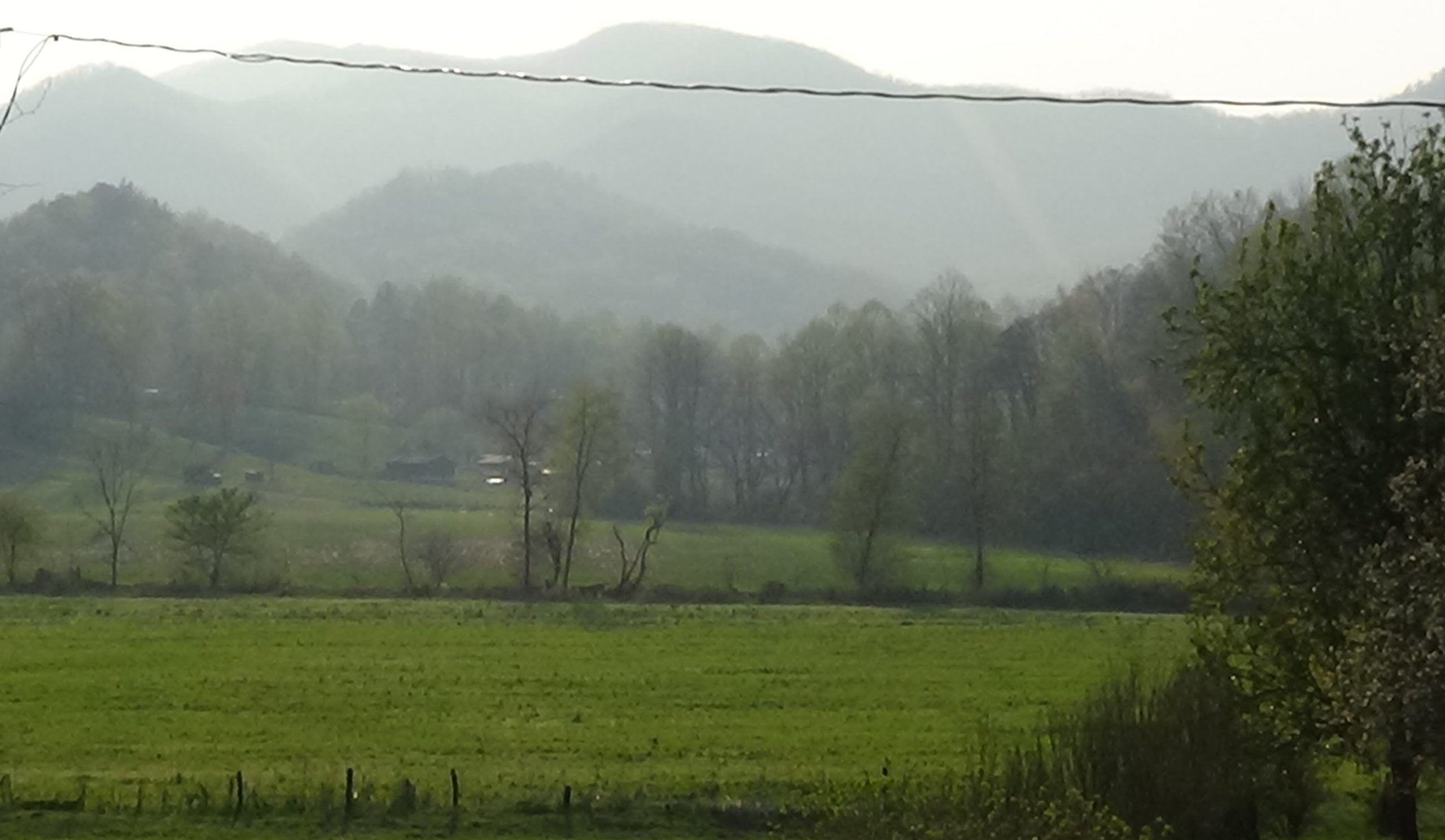
History: Skeena Creek is marked by the line of trees running side to side on the far side of the fields. The army camped along the creek, probably in this area where it joins the river, on Monday, September 16, 1776.[1]

The Long Road to Nowee
- Get back on Prentiss Bridge Road in the same direction you were traveling.
- Drive to the stoplight at US 23/441, and go straight when green, noting or resetting your trip odometer reading.
Note: The route becomes Addington Bridge Road. - Drive 0.8 miles, and turn right on South Skeenah Road.
History: The army apparently followed either the north or south fork of Skeenah Creek to head west (see Footnote 2). This route, the only modern road that goes all the way past Kate Knob, parallels the south fork. - Drive 3.7 miles as the road becomes North Jones Creek Road, and veer right to stay on that.
- Drive 2.0 miles to West Old Murphy Road, and turn right.
Tip: As of April 2023, the road sign was turned to show “Maidens Chapel Road,” which is directly across the intersection. - Drive 1.6 miles to US 64.
- Watch for traffic, drive straight across, and just past the highway, pull off to the right at the utility pullout.
Westward Ho
![]() If you did not follow the previous directions for the army’s detour, drive to the intersection of US 64 and Carl Nolan Road on the right: 35.1385, -83.4859. Turn right, and immediately pull off to the right at the utility pullout.
If you did not follow the previous directions for the army’s detour, drive to the intersection of US 64 and Carl Nolan Road on the right: 35.1385, -83.4859. Turn right, and immediately pull off to the right at the utility pullout.
Look across Carl Nolan Road.
On Tuesday, September 17, Rutherford’s army arrived from the left at “Nowee,” according to Lt. William Lenoir[2], and went another mile up a creek. Neohee was in the valley across Cartoogechaye Creek, which runs side to side below you. They probably went up Poplar Cove Creek on the other side of US 64, which goes almost all the way to the gap they crossed the next day.
The most-used trading path between Nĭkwăsĭ´ and the Cherokee towns across the mountains went over Wayah Gap. That path is now Wayah Road north of here (to your right). Historians have debated why Rutherford took the “wrong” path to go west, here along the route of today’s US 64. But Monday’s detour explains it. It took the army around the cutoff to Wayah Gap, which turned north at winding Cartoogechaye Creek more than two miles back toward Franklin. As you look around, you can see that the obvious route west from here is along this valley.
When you drive the next segment, where the highway narrows to two lanes and crosses Cartoogechaye Creek near here, note your odometer reading. Neohee was to your right, so you will be in the area of Tuesday’s camp after driving one mile.[3]
The next step takes a route that starts with a classic winding mountain road, with a 25-mph speed limit at places. Larger vehicles may wish to stay on the highway to the second set of coordinates.
![]() Drive to Old US 64 on your right, and turn right, at: 35.0558, -83.6124. Drive 9.6 miles back to modern US 64 (at 35.0340, -83.7408). In the valley, pull over wherever you safely can to read the text below.
Drive to Old US 64 on your right, and turn right, at: 35.0558, -83.6124. Drive 9.6 miles back to modern US 64 (at 35.0340, -83.7408). In the valley, pull over wherever you safely can to read the text below.
The army apparently picked up Thompson Creek downhill to the left, which eventually joins another stream to become Shooting Creek just left of the bridge you will cross in the valley. The campsite on Wednesday the 18th was likely in that area.][4]
A soldier on the march, William Dells, wrote about this day’s segment: “took the Mountains, which is hardly Any rise in Going up but when up You See a Most Delightfull (sic) prospect As Ever Your Eyes Beheld. You may See as far as your Eyes will Lett (sic) You. The Valleys Looks very Pleasent (sic) but the Mountains is Impregnable. Sent out Scouts of foot & horse to range who took from the Enemey (sic) 60 (pounds) Powder 24 horses Kettles & Other…”
Lenoir adds that Maj. Andrew Pickens caught up to them with the news that the South Carolina army had arrived. (Pickens served with the S.C. militia all seven years of the war, playing an important role in many battles and rising to brigadier general.)
Next the troops followed Shooting Creek to the Hiawassee River. US 64 parallels the creek to what now is Chatuge Lake, and then goes around the lake before picking up their path along the river north.
![]() Drive to the parking lot at Clay County Recreation Park in Hayesville: 35.0460, -83.8107. Park in the upper right corner of the lot, and walk the short trail by the baseball field to the bridge visible in the distance.
Drive to the parking lot at Clay County Recreation Park in Hayesville: 35.0460, -83.8107. Park in the upper right corner of the lot, and walk the short trail by the baseball field to the bridge visible in the distance.

What today is called “Stickback Mound” was the center of the town of Quanasee, an important crossroads of several trading paths, as signs at the site explain. The town spread out on the flats across the bridge, with log cabins surrounded by cornfields and paths in between. As the army approached from the right (when facing the mound) on Thursday the 19th, Dells says troops from Rowan County split farther to your right, those from Mecklenburg took the center, and Tryon County’s went to your left. (Tryon County, named after a former British governor, was broken up and renamed during the war.) Unlike nearly all of the Cherokee towns and villages the army encountered, this one still had residents. Dells says, “we Gott (sic) round the Town Kill’d 6 (and) wounded 2 took an Old Fellow & a Lad prisoners.”
On Friday, Dells reports, “Some… party Came in and brings us Word of a Great Discovery of Indians Driving Hourses (sic) & Cattles (and) they sent for more Aid. Sent 140 Light Horse to their Assistance.” Most of the men traveled on horseback, but the ”light horse” were armed and trained to operate as cavalry. The others remained “at Camp cutting Down Corn.”
Cherokees remained in the area, because Lenoir says two are killed and more are taken prisoner. Before leaving here, the troops had burned the town’s council house on top of the mound, the homes, and the granaries, confiscated or killed the livestock, and destroyed the crops.
![]() Drive to the intersection of Fires Creek Road and River Oaks Drive, on the left at: 35.0706, -83.8169. Park by the guardrail on the left.
Drive to the intersection of Fires Creek Road and River Oaks Drive, on the left at: 35.0706, -83.8169. Park by the guardrail on the left.
On Saturday the army marched two miles and attacked a town Lenoir calls Chowa, probably located here where Tusquitee Creek next to you enters the river.[a]
![]() Continue up Fires Creek Road to Albone Branch Road at: 35.0774, -83.8475. Pause in the entrance to that road, on the right.
Continue up Fires Creek Road to Albone Branch Road at: 35.0774, -83.8475. Pause in the entrance to that road, on the right.
Lenoir said the army marched another three miles before camping on Saturday. Based on that mileage and the topography along the river, either the inside bend across the river from here or the next cove downriver is the likely campsite.
A detachment came in to camp with 46 prisoners: Two men, probably white traders, with their Cherokee wives and children, four other white men, and four enslaved Black people. With these came 80 cows, 70 horses, 30 piles of deer skins, “and other Rich plunder.”
![]() Those with larger vehicles may prefer to skip the next curving route by going straight at the bridge and on to US 64. Turn right and after crossing the river, pull into the pullout on the right side just past Mission Road at: 35.0612, -83.946.
Those with larger vehicles may prefer to skip the next curving route by going straight at the bridge and on to US 64. Turn right and after crossing the river, pull into the pullout on the right side just past Mission Road at: 35.0612, -83.946.
To stay closer to the army’s path along the river instead, note or reset your trip odometer and:
- Continue on Fires Creek Road 4.3 miles.
- Just before the bridge at the river, turn right onto Mission Dam Road.
- Drive 2.1 miles, and turn left on Mission Road.
- Drive 1.3 miles to US 64, and turn right into the large pullout on the right.
If you wish, read the sign for Valleytown Baptist Mission on the right edge of the pullout.
People with small vehicles can get a better view of the Rutherford location by driving a short way downhill to the paved farm lane entrance on the right just before the river.
Below you, spread out along this side of the river, was Aquonaste. The army arrived here on Sunday the 22nd and destroyed the town. Lenoir says “a number of Indians fired on 2 of our men,” probably scouts moving ahead of the army, killing Joshua Turner of Rowan County. They wounded John Howard, “who says he killed 1 Indian and had several guns shot at him as he Crossed a Creek.”
During the march here, soldier John Roberson began ranting that “‘some of his relatives’” had been killed by the Cherokees. He then killed an elderly prisoner. Rutherford had him arrested, intending a court martial, but many of the soldiers were “‘so incensed against the Indians that the thought of seeing Roberson punished seemed rather disgusting.’” He was released.
In either a separate incident or a completely different telling, Ephraim McLane “‘rode up along side of one of the Indian prisoners… (and) shot him in the face, but not killing him, the Indian made a grab at the tomahawk of a solder within reach.’” McLane killed him with the butt of his gun. To Rutherford’s reprimand, McLane responded “‘he be d—-d if he wouldn’t kill every Indian that came in his way’” because of his murdered relatives. Again he was let go.[b]

Once camped, the horses, cattle, other plunder, and sadly, the enslaved people, were sold to members of the army. Rutherford made these flats a base of operations for the next four days, sending out detachments to other Cherokee settlements in the area while laying waste to the fields and homes of Aquonaste. Lenoir says 25 men were sent to find Williamson’s S.C. army on Tuesday, and an early frost dusted the ground the next day.
On Thursday the 26th, Rutherford rode out with other officers and 100 light horse to meet the South Carolinians, apparently knowing they were near. They met up somewhere off to the right—finally, after missing each other at Nĭkwăsĭ´.
Earlier in the day, the South Carolinians had burned two towns we will visit to the west, and then Echochee, in modern Brasstown south of the river. They then crossed the river and were moving up this side. They saluted Rutherford’s army with 13 shots from small cannons called swivel guns, one shot for each of the new states.[5] Then they camped beside each other for the night.[6]
The next day, the two armies marched a short distance west together and then the South Carolinians turned south for home, probably taking a trading path that existed then back through Brasstown. Archaeologists found a burned split-rail cabin and ground stains probably marking a village where Brasstown Creek enters the Hiawasee, out of site along the bend to the right. “Sadly, the charred remains of an old man who apparently was trapped in the burning structure” were found as well.[7]
![]() Drive to the intersection of Old US 64 and Hendrix Road, watch for traffic, and park in the pullout across Old 64 (on the left): 35.0786, -83.9773.
Drive to the intersection of Old US 64 and Hendrix Road, watch for traffic, and park in the pullout across Old 64 (on the left): 35.0786, -83.9773.
The Cherokee town of Hiawassee[8] extended across the river bottoms below you along Peachtree Creek, which is traced by the line of trees directly south. Its townhouse was on what now is called Peachtree Mound, about three American football fields past the creek along the river and dating back to perhaps 1000 BCE.[c] The mound was mostly flattened when excavated by archaeologists, but they found a burnt clay floor from a structure on the top. The S.C. army burned the town on the 26th on its way to Echochee and meeting the N.C. army, which passed by the next day.
Closing the Loop
The Trace bypasses downtown Murphy, but you may wish to visit the Cherokee County Historical Museum there to see an impressive display of Native American arrowheads and other artifacts, and read about other stops on the Cherokee Heritage Trail. To do so, after your mapping app takes you back to US 64, continue straight at the next light instead of turning right onto US 19/74. The museum is on the street you will be on, on the right just before the courthouse, at 87 Peachtree Street.
![]() Drive to the gravel parking lot by the Murphy High School football stadium: 35.1004, -84.0192.
Drive to the gravel parking lot by the Murphy High School football stadium: 35.1004, -84.0192.
These river bottoms were the site of Tlanusi’yi—“Clanuce” or “Canucca” per the militia—the first town destroyed by Williamson’s army on Thursday the 26th. Its townhouse site is probably covered by the parking lot across the street.
The town name means “Place of the Leech.” A Cherokee story says giant red leeches lived in a big hole in the Valley River just before it empties into the Hiawassee (now under the Tennessee Street bridge near downtown). Because the leeches stole some passing children, Cherokee parents long kept their families away from it. The story says two boys eventually decided to heat up a large bolder with fires and push it into the hole, which killed the leeches.[9]
![]() Re-set or note your trip odometer reading, and then drive up US 19/74 to its intersection with Business 19 in Andrews: 35.2028, -83.8414. Along the way, use your odometer readings to spot the next few locations, pulling off on the wide shoulder for safety. Read the text from here to the next arrowhead before you start.
Re-set or note your trip odometer reading, and then drive up US 19/74 to its intersection with Business 19 in Andrews: 35.2028, -83.8414. Along the way, use your odometer readings to spot the next few locations, pulling off on the wide shoulder for safety. Read the text from here to the next arrowhead before you start.

As did the army, you will travel up the “Long Valley,” which Lenoir described as “the most beautiful Valy I’de (sic) seen.” It had been heavily populated by Cherokees in formal towns and smaller villages and campsites, considered a major source of grain for the entire nation. Most moved west due to these and later campaigns, but many filtered back after the Revolution ended. Nearly 3,000 Cherokees were in the valley by the time U.S. troops forced them to leave in 1838.[10]
Williamson’s S.C. army had already attacked the villages in the valley, coming down in the opposite direction than you are taking.
![]() At 4.0 miles from the high school, look left.
At 4.0 miles from the high school, look left.
The town of Canoste was on and around a mound in this area, one of two towns destroyed on Wednesday the 25th.
![]() At 6.0 miles, look toward the river.
At 6.0 miles, look toward the river.
Lenoir says the N.C. army camped in this vicinity by the river on Friday the 27th.
![]() At 9.7 miles, look right.
At 9.7 miles, look right.

Also destroyed on Wednesday by Williamson’s army was Little Tellico, so called to distinguish it from larger Tellico in today’s Tennessee. The town was along the river on this side.
In 1838, Cherokee farmer John Welch, allowed to stay after the removal, helped others of his nation escape it. Afterward he bought land for them to live on in this area, reclaiming the site of Little Tellico.[11] You will pass the Welch Farm Boating Access area shortly on your right.
![]() At 10.8 miles, look ahead and to the left to spot the Andrews/Murphy Airport.
At 10.8 miles, look ahead and to the left to spot the Andrews/Murphy Airport.
A town, Tasetchi or perhaps Elijoy, was centered near the airport buildings. Airport construction erased its mound. Cherokee sources differ on the name, but the South Carolinians burned it on Tuesday.[12] At this point they were moving slowly, making only two miles a day, because they sent units up the mountains on each side. They may have hoped to surprise the residents, and/or they were trying to prevent another ambush like they suffered at the Battle of the Black Hole, as you’ll see. By Wednesday they must have realized the villages were all abandoned, because they picked up speed.
![]() At the coordinates in Andrews, turn right onto Business 19. Pull over wherever you safely can to read the following.
At the coordinates in Andrews, turn right onto Business 19. Pull over wherever you safely can to read the following.
Andrews was the site of Tomotla, also likely destroyed on Tuesday by the S.C. army.
Rutherford’s army probably followed this route to the point where you turn north up Junaluska Creek during the next segment. A trading path continued directly east from there, down to and across the Nantahala River.[13] That route now is blocked by Nantahala Lake.
S.C. militia soldier Arthur Fairies says his army got to the far side of the Nantahala on Sunday the 22nd, two days after the Battle of the Black Hole. Its left wing crossed the river to this side, he writes, while the right took to the high ground on the other. The left and center “marched through a dreadful valley and wonderful thickets… to a place more clear,” which probably put them at the top of today’s lake at Wine Spring Creek.[14] After you pass up the Junaluska Creek Valley and over a gap, when you see the lake on the right, that is the area. The next day, he says scouts for the army marched over two mountains to the path that the rest of the army took, “abounding with laurel thickets and sidling swamps.” That path is likely under today’s Junaluska Road, which you will drive on.[15]
A Cherokee named Tsunu’lahufi’ski lived along the creek now named for him using the English version of his name: Junaluska. Like John Welch, he helped Cherokees escape removal by the U.S. Army. President Andrew Jackson had ordered the Cherokees west. Ironically, Cherokees recruited by Tsunu’lahufi’ski won the 1814 Battle of Horseshoe Bend (Ala.) for U.S. troops under… Gen. Andrew Jackson.
From the point at the other side of the lake where Wayah Road finally leaves the water and begins climbing toward Wayah Gap, until you reach the battle site, the road is believed to be on top of the trail both armies followed. Williamson’s camped at Wayah Gap on Friday the 20th. Rutherford’s camped on this side of the river on Saturday the 28th.
![]() Drive to the Battle of the Black Hole location and park by Locust Tree Drive on the left at: 35.1618, -83.5201. On your mapping app, choose the route that uses Junaluska Road and Wayah Road.
Drive to the Battle of the Black Hole location and park by Locust Tree Drive on the left at: 35.1618, -83.5201. On your mapping app, choose the route that uses Junaluska Road and Wayah Road.
After the N.C. army crossed the Black Hole battlefield here on Sunday, as described on the battle page, it likely followed Cartoogechaye Creek most of the way back to Nĭkwăsĭ´. The exact route is unknown, but US 64 parallels the creek to Franklin. Your mapping app will take you that way to the next location if you are on the Cherokee Campaigns Tour. The army continued across the Little Tennessee, using a ford below the mound, and camped near or on the path used before they first got to Nĭkwăsĭ´. From there they headed home using the same route they had taken this way (see the map on the “Rutherford Trace” page).
Go to the Battle of the Black Hole page.

More Information
Only sources mentioned on this page are listed here, though information is drawn from many others named on related pages. The footnotes refer to “Dells 2” because Dells recorded two itineraries: his own with units left near Nĭkwăsĭ´ (Dells 1), and a report from those who went west with the main army (Dells 2).[16]
- Dean, Nadia, A Demand of Blood: The Cherokee War of 1776 (Cherokee, N.C.: Valley River Press, 2012)
- Dells, William, ‘A Journal of the Motions of the Continental Army Commanded by the Honble. Griffith Rutherford Esqr. Brigadear Generall Against the Cherokee Indians’, 1776, The Filson Historical Society, Arthur Campbell Papers, Mss. A C187 26, William Dells Military Journal <https://filsonhistorical.org/wp-content/uploads/FHS-Mss-A-C187-26-William-Dells-Military-Journal.pdf> [accessed 26 January 2023]
- Duncan, Barbara R., and Brett H. Riggs, Cherokee Heritage Trails Guidebook (Chapel Hill: Published in Association with the Museum of the Cherokee Indian by the University of North Carolina Press, 2003)
- Exhibits, Stickback Mound, Hayesville, N.C. [Viewed 4/12/2023]
- Graves, Will, tran., ‘Arthur Fairies’ Journal of Expedition Against the Cherokee Indians from July 18th, to October 11th, 1776’, Southern Campaigns of the American Revolution, 2.10.1 (2005) <http://www.southern-campaigns.org/wp-content/uploads/2020/11/v2n10.pdf> [accessed 3 April 2023]
- Hamilton, J. G. de Roulhac, ‘Revolutionary Diary of William Lenoir’, The Journal of Southern History, 6.2 (1940), 247–59 <https://doi.org/10.2307/2191209>
- Lenoir, William, ‘Account of the Expedition against the Cherokee Indians, in 1776, under Gen’l Griffith Rutherford’, 1835, Museum of the Cherokee Indian Archive, 2010.253.0207, Rutherford Expedition: Miscellaneous
- Rozema, Vicki, Footsteps of the Cherokee: A Guide to the Eastern Homelands of the Cherokee Nation, Second (Winston-Salem, NC: John F. Blair, Publisher, 2007)
- Saye, Rev. James, ‘Memoirs of Major Joseph McJunkin’, 1848 <http://www.carolinamilitia.com/wp-content/uploads/2014/03/Memoirs-of-Major-Joseph-McJunkin.pdf>
-
Setzler, Frank M. (Frank Maryl), Jesse David Jennings, and T. D. (Thomas Dale) Stewart, Peachtree Mound and Village Site, Cherokee County, North Carolina (Washington : U.S. Govt. print. off., 1941) <http://archive.org/details/peachtreemoundvi00setz> [accessed 8 April 2023]
- Smith, Betty Anderson, ‘Distribution of Eighteenth-Century Cherokee Settlements’, in The Cherokee Indian Nation: A Troubled History, ed. by Duane H. King (Knoxville: University of Tennessee Press, 1979)
- Ward, H. Trawick, and R. P. Stephen Davis, Time Before History: The Archaeology of North Carolina (University of North Carolina Press, 1999)
[1] Lt. William Lenoir (in Hamilton 1940) and soldier William Dells (1776) agree the march distance was 6 miles. “Dells 2” (see “More Information”) added that it went to a “creek (that) waters the Tennessee.” That distance and description matches this location. (The phrase “waters the [larger river]” was a common term of the time meaning the stream is a tributary, as Skeena Creek is for the Little Tennessee.) Also, adding this day’s mileage to the next, 8 miles per Lenoir, totals 14; but their next campsite is only 8.5 miles from Nikwasi Mound, so they could not have gone directly west this day. The most comprehensive modern book on the campaign (Dean 2012) agrees they came to Skeena Creek.
[2] Lenoir gives the day’s march as 8 miles, and the modern route in the previous section totals 8.1 miles from US 23/441. Dells’ number of 16 miles is far off, but he gives the directions taken as west (and then) northwest, which aligns with the route along Skeenah Creek (see “Out of the Way”) and Jones Creek. Duncan & Riggs (2003) places “Neohee” at the later Sandtown in the valley below you (described under “Historical Tidbits” on the Battle of the Black Hole page).
[3] Duncan & Riggs 2007.
[4] Lenoir says they marched 12 miles over two mountains to the head of a creek of the Hiawassee. This route crosses Winding Stair Gap and Chunky Gal Mountain, and Shooting Creek is a Hiawassee tributary. Another option is Tusquitee Creek to the north. However, the next day’s march of 12 more miles would overshoot their next destination from there, whereas it is roughly that distance from the head of Shooting Creek. Also, Dells 2 lists the direction of travel as West-Southwest, which fits this option, whereas Tusquitee is West-Northwest. Dean concurs with this being the route.
[5] Dells 2; Lenoir in Hamilton.
[6] Some sources claim this meetup happened in Murphy. But Fairies says the S.C. army that was headed in this direction burned Canuce, which we will visit there, and then Echochee before meeting the N.C. army. Echochee was in today’s Brasstown, close to here across the river to the right. Subtracting Fairies’ total day’s march of 10 miles from the first 2 to Canuce leaves 8 miles. Lenoir reports the N.C. army marched 7 miles the next day before turning up the Valley River. The mouth of Brasstown Creek is roughly 7 miles by river from Murphy. Dells says the S.C. army came up the west side of the river—this side—when they met. Dells has this happening a day later, but Lenoir and Fairies agree it was the 26th.
[7] Trading path: Exhibits, Stickback Mound. Archaeologists and quotation: Ward & Davis 1999.
[8] Not to be confused with the Overhill Town by the same name in modern Tennessee.
[9] Duncan & Riggs, Rozema 2005.
[10] Duncan & Riggs, Smith 1979.
[11] Ibid.
[12] Ibid. Exhibits, Stickback Mound, appear to place Elijoy here.
[13] Exhibits.
[14] Fairies says they marched five miles to the Nantahala (which he misidentifies as the Tennessee), and four miles farther as described. Since the left wing crossed the river (thus to the west side), they were heading north.
[15] Fairies, who apparently is with a scout unit, reports an 8-mile march “mountain to mountain” to the “waters of the Highwassa” (see Footnote 1 regarding that phrase). It’s unclear if he means the Valley River and/or its tributaries, but the upper river and several creeks converge in Andrews. The “mountain to mountain” statement suggests he crossed the mountains on either side of the creek, but the only trading path near their campsite came down where Junaluska Road is today (Exhibits). A possible explanation is a spur off the Lambert Mountain ridge-line on the east side of Junaluska Creek, which cuts back to the Nantahala west of their campsite. Perhaps they crossed it and the main ridge-line before getting to the creek, while the army took the long way around on the trading path. Fairies’ mileage is off, unless this page’s starting and ending points are wrong. It is roughly 12 miles by that route to Andrews. Though often remarkably accurate to known landmarks today, they had no means of measuring distance, so all mileage figures were estimates.
[16] In a transcript of his handwritten journal (Dells), pages 1-3 cover the N.C. army’s march to modern Franklin. Pages 3-5 cover the troops left behind through Sept. 29, when it says the main army rejoins them. Then it picks up at Sept. 16 again, and covers the movements of the main army until the armies recombine and start for home.
[a] The map at Stickback Mound locates a town here, but neither it nor any Cherokee or academic source AmRevNC found provides a name.
[b] Quotes are from Dean; Lenoir (Hamilton) only mentions the Robinson story.
[c] Modern sources claim the mound dates as far back as 8000 BCE. But the earliest items found by archaeologists only date to the Woodland Culture, and their report merely says the site was occupied by Cherokees continuously back to “pre-white contact” (Setzler, Jennings & Stewart 1941).