
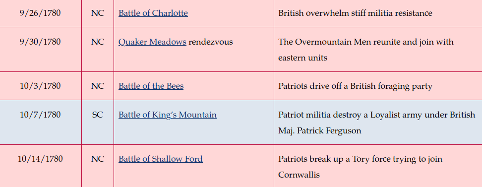
Location
Other maps: Bing, Google, MapQuest.
Coordinates: 35.3124, -80.8641.
Type: Stop
Tour: Race to the Dan
County: Mecklenburg
![]() Difficult
Difficult
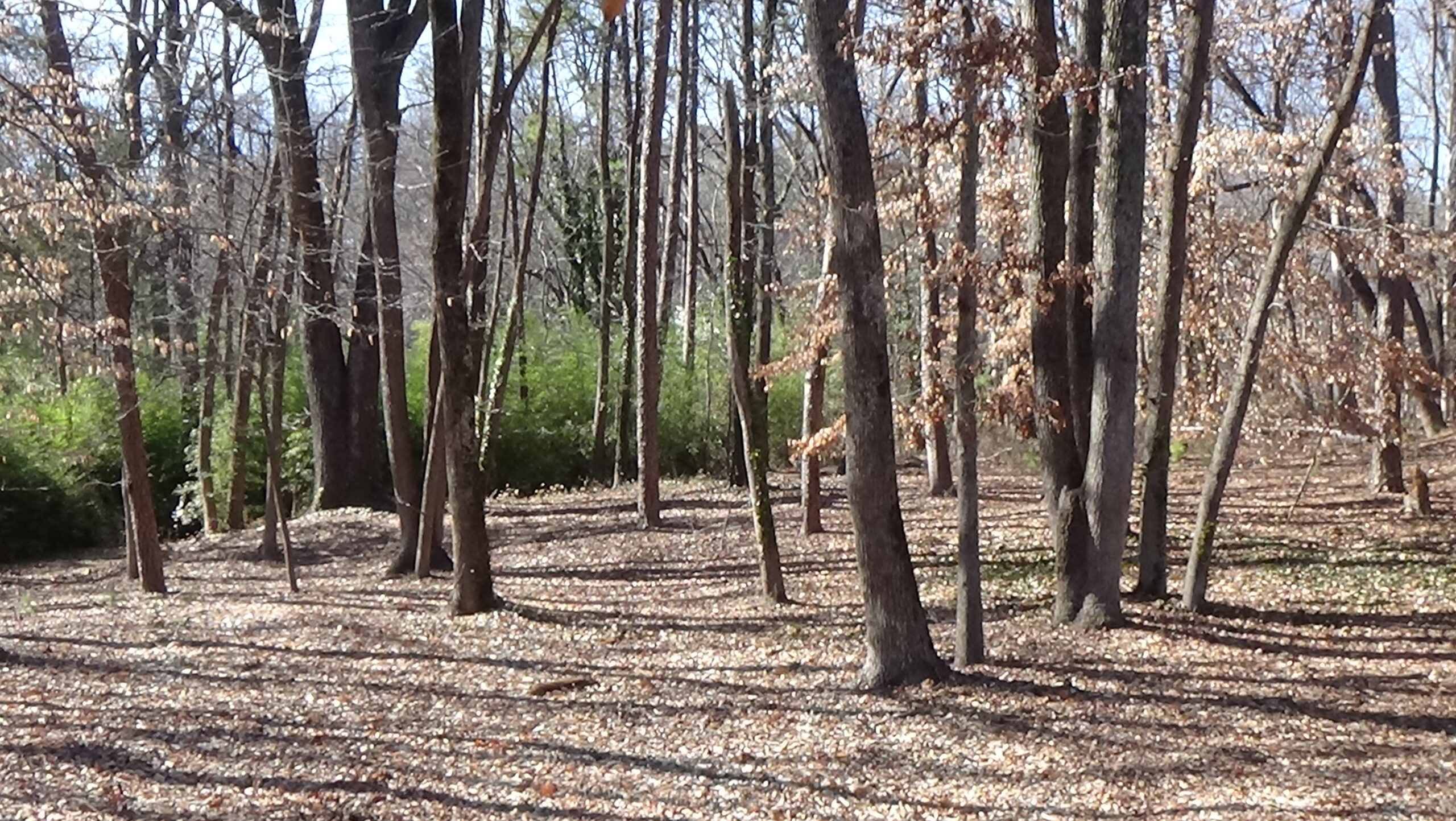
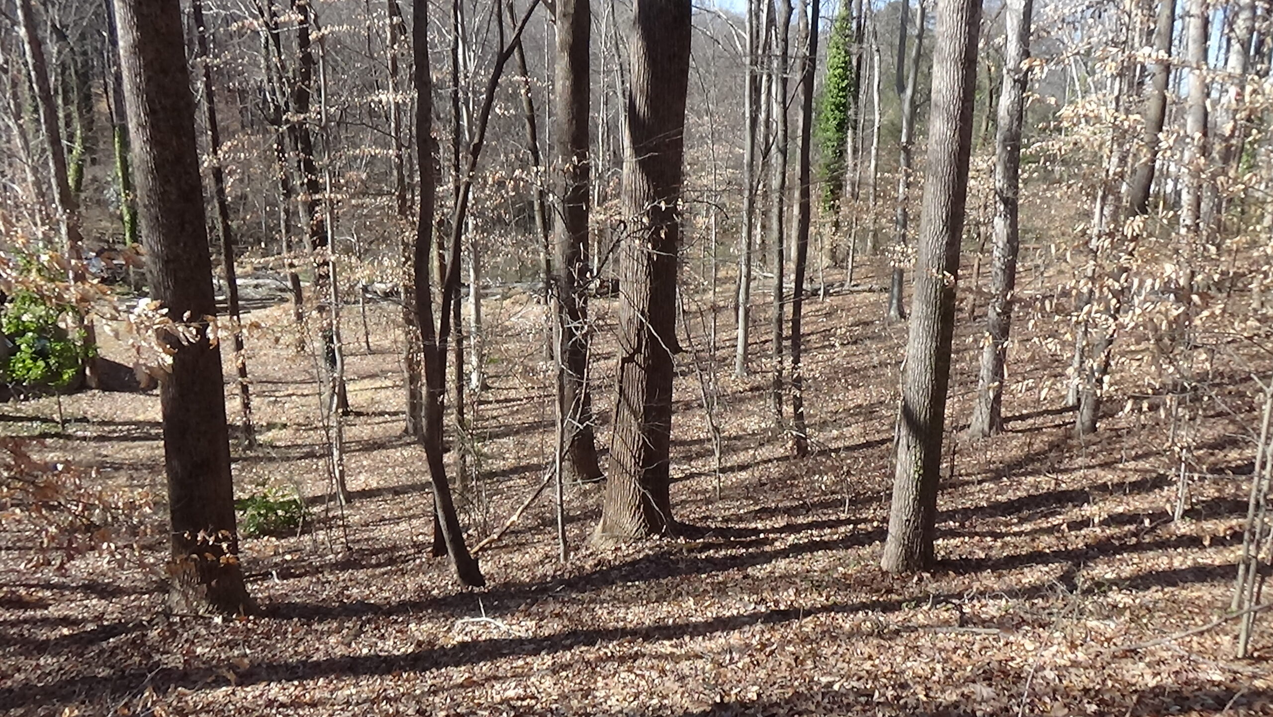
You can see the general location of the farm buildings where this skirmish took place from the parking lot of the McIntyre Farm Historic Park, or you can explore further on foot. The trails are relatively flat and solid, but some people with mobility issues might find them difficult.
Context
Lt. Gen. Lord Charles Cornwallis’ British army occupied what now is Uptown Charlotte in September of 1780, and began gathering supplies from the area.
Situation
British/Loyalist
Local Patriots or “Whigs” kept harassing the foraging parties. So when 40 empty baggage wagons were sent to a mill on Hopewell Creek north of town, Cornwallis ordered a 450-man force under Capt. John Doyle to protect it. They were mostly Loyalist or “Tory” infantry, plus 60 cavalry, probably British.1 The Tories planned to plunder farms along the way.
Patriots
Capt. Jack Thomson (or Thompson) and 13 of his part-time “militia” soldiers may have waited for the foragers in a cornfield three miles from Charlotte, chosen because the corn was still standing—most fields had been harvested. They let the foragers pass, and then paralleled them in the woods, keeping a half-mile away.2 A later version of this story says a boy spotted the foragers and rode ahead to warn farmers. He then notified Thomson at his home where Latta Plantation was built later, north of here.3
Date
Tuesday, October 3, 1780.
Timeline
Imagine the Scene
McIntyre’s Farm
The earliest sources on this raid differ on major details. This page follows an 1825 newspaper article4 for the basic story, adding details from other sources.
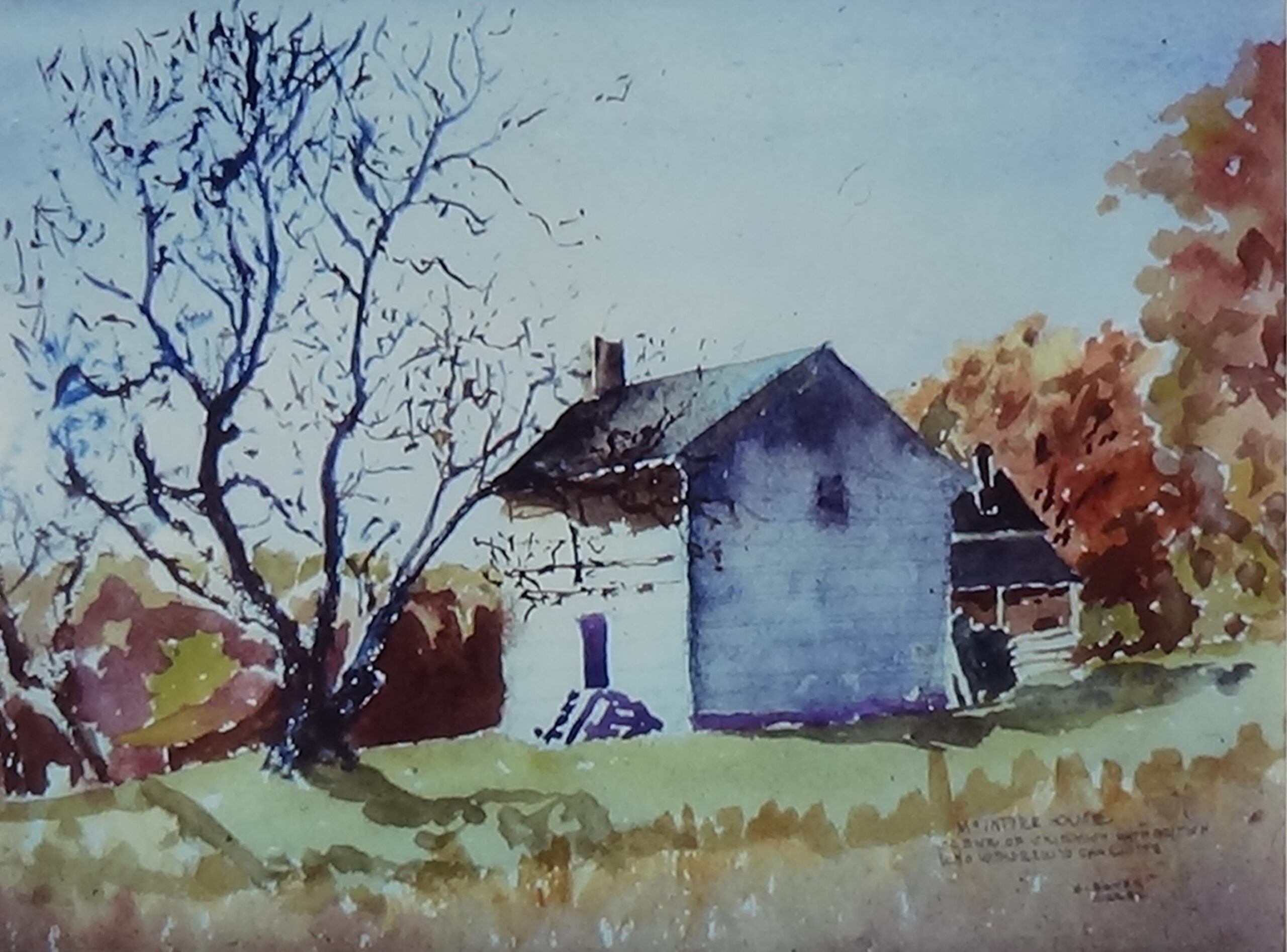
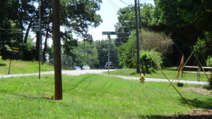
Take the loop trail from the right side of the parking lot. Stop where the trail begins to curve left, away from Beatties Ford Road. Turn left to face across the park. The McIntyre farmhouse was diagonally to your left, in front of or across the trail on the far side.5
Robert Kerr probably built a farmhouse here around 1746. “The house… was 20 by 26 feet, built of hand-cut, squared logs of hard pine, with saddle-notched (interlocking) corners and caulked with clay.” It has doors on the front and back—right and left sides in your view—opposite each other for airflow. But there is only one window, near the point of the roof on the near side. A chimney is on the other end.6 The barn is somewhere in the area of the modern parking lot.
Kerr’s daughter married Frances Bradley in the house. So did another (unnamed) daughter and William McIntyre, who had moved to the area in the 1760s. They inherited the 440-acre farm.
Look to your left up Beatties Ford Road.
The modern road follows the same route as the one at the time, first a Native American trading path,7 leading to Beattie’s Ford across the Catawba River (now under Lake Norman). Near here, the Patriots shadowing the foragers pick up a small stream running at the bottom of the slope beyond the farmhouse.
The McIntyre family is here, including six-year-old Isaac, when the Tories arrive up the road. They likely take refuge in the house. One source says William is with Thomson.8 The British column halts long enough to drop off 10 wagons and 100 men. Capt. Doyle then continues north with most of his force. The men here tie their horses to the farm’s wagons. They begin emptying the McIntyres’ barn of oats; stealing pigs, ducks, and chickens; and rummaging through the house.
Bees Bring Bigger Stings
Continue along the trail. This area became a gold mine in 1835, worked until the 1880s. Depressions along the trail are the remains of exploratory pits.
Just before the trail turns back toward the parking lot, stop by a group of boulders on your left. Face the lot.
Thomson and his men, including Frances Bradley, sneak along the stream past the foragers, and then come up to the top of the ridge from behind you. This places them “60 or 70 steps” away from the Loyalists on the far side of the house, well within musket range.9 The men spread out, putting at least 10 feet between each, to make themselves seem like a larger group. They take positions behind trees and large rocks like these at your feet, prepare their guns, and await their chance.

Early sources differ on what happens next. One says a Tory knocks over one of the farm’s beehives, likely made from a hollow log, while trying to steal it.10 The Loyalists come under attack from the bees, prompting laughter from an officer as his men scatter. Another version says nothing of the hive, instead stating a sentinel near this spot heard the Whigs and became “alarmed.”
Either way, Thomson shoots the sentinel, which causes the rest of his men to open fire at the distant raiders.11 Two aim at the same man; when the first hits him, the second finds another target. Most of the targets fall.
Some of the Loyalists run for their horses, while a few begin to shoot back. Many of the Whigs are already retreating. Thomson apparently has a rifle, more accurate at a distance: His second shot wounds the officer in command, who was standing in the barn doorway, 400–500 feet away. The man dies two days later.
Turn around and look at the hillside.
The Patriots scurry down the slope. Doyle has heard the firing from a half-mile down the road, and fears he is under attack from a larger Patriot force. Likely for the same reason, the Tories here don’t pursue Thomson. Doyle orders a retreat back in this direction.
Thomson’s men continue down the branch that brought them here, marked now by a line of greenery at the bottom of the slope to your left. It feeds into today’s McIntyre Creek.12 They follow the creek to where the road fords it, and take a position on a high bank some 40 yards away. When the front of the column is in range, they fire a volley, and then retreat.
Some of Doyle’s men spread along the opposite bank and began shooting at the Whigs. The Tories have brought war dogs, and let them loose. According to one man on the scene, “‘The dogs came on the trail of these retreating men, and the leading one sprung upon the heels of a man who had just discharged his rifle. A pistol shot laid him dead, and the other dogs, coming up to him, paused, gave a howl, and returned.’”13 (One man’s daughter said the bitten-man’s brother shot it.14) Some of the cavalry chase Thomson’s men a short distance along both sides of the creek. But the woods make pursuit difficult, and they break off without catching any.
Turn back around, walk to the house site, and look toward the parking lot.
Some of the Tories form a line of battle as a rear guard. The larger force continues past toward Charlotte. But horses pulling the wagons are killed somewhere in the distance, which blocks the road and adds to the confusion. After the wagons finally get through, the rear guard is ordered back and the last of the Loyalists disappear over the ridge ahead of you.
Their danger is not over, however. The delay allows more Patriot farmers to arrive and line the road. They keep to the woods and pick away at the exposed Loyalists. The Tories retreat headlong to Charlotte, a scene reminiscent of the British retreat from Lexington and Concord (Mass.) in 1775. A newspaper of the time reported the wagons “‘drove back with such precipitation (speed) that… many of their horses fell dead in the streets on their return.’”15
A prisoner confined in the county courthouse, at the intersection of today’s Trade and Tryon streets, overhears an officer ask one of those with the column if they had run into Patriots. The man swears “‘they found a rebel in every bush.’”
For their trouble, the force has gathered at most two wagon-fuls of food.16
1 “Affair Near Charlotte, 1780” (1825).
2 Ibid.
3 Johnson 1851.
4 “Affair…”
5 The large tree in that direction as of 2026 appeared to be the same one shown on the 1932 watercolor on this page, which also depicts the rising landform left to right with lower ground close behind. AmRevNC found old materials from a house where the painting shows a newer home in the background. Counting 50 steps along the trail on the far side from our next stop led AmRevNC to that spot, the distance reported by Draper (2003) as the distance from the Patriots to the house. A contemporary source said the Tories were “60 or 70 steps” from that position, which also fits, presuming the Tories were between the house and the barn around today’s parking lot (Painting: Boyer, Jr., Martin E., ‘The McIntyre House: Scene of Skirmish with British Who Withdrew to Charlotte’, 22 November 1932, Boyer Family Papers, privately held by Arabelle Plonk Fedora, Winston-Salem, N.C.).
6 King (1957), a newspaper article based on a McIntyre family history. McIntyre’s move date and the quotation are from “The McIntyre Historic Site.” See also Johnston & Waterman (1941), which appears to get the build date wrong.
7 Wright and Morrill 1994.
8 Johnson.
9 Graham 1904.
10 Johnson.
11 Graham.
12 Some sources refer to Long Creek, but at 2.5 miles that is too far away for the timing of these events. McIntyre Creek is a half-mile north.
13 Quoted in Lewis 2014.
14 Swann 1875.
15 Norris and Barefoot 2006, and Morrill. Horses: The Pennsylvania Packet, quoted in Blythe and Brockmann 1961.
16 Two wagons: “Affair…”.
17 Federal Writers’ Project (1939). House razing: Blythe and Brockmann.
18 Most professional historians do not believe the Declaration happened, suggesting it was a misremembering of a document now called the Mecklenburg Resolves from 11 days later. See the related footnote on the Battle of Charlotte page.
← Davidson’s Grave | Race to the Dan Tour | Torrence’s Tavern →