Location
Other maps: Bing, Google, MapQuest.
Coordinates: 35.9951, -76.9473.
Type: Stop
Tour: Rebellion
County: Bertie
 Full
Approach the coordinates from downtown Windsor, heading south on Sutton Drive. Park at the curb just before Gray Street, wherever you can see the white house at the top of the hill on the right.
For a closer look, smaller vehicles can turn right onto Gray, which narrows to driveway width with limited turnarounds. However in warmer months, when trees have their leaves, there is no good view of the house. Please respect the homeowners’ privacy.
A Halting Start for a County Seat
John Gray bought 1,000 acres including a Cashie River landing here in 1729 and had a plantation built, which his son William inherited. William offered 100 acres to the colony to create a county seat. But residents of the town where the Bertie County Courthouse sat, a few miles upstream, objected.[a]
The Provincial Assembly appointed a committee in 1767 to recommend the best site for the courthouse. Given the poor condition of the existing buildings and the crooked course of the river there, they recommended Gray’s land become “New Windsor” (presumably after the town around Windsor Castle, a royal residence in England). The land was sold and town founded the next year, and the first lots sold.
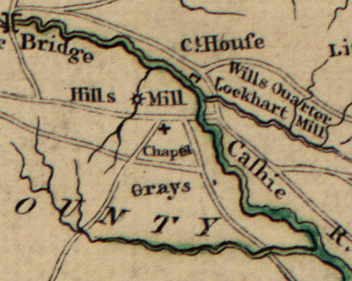
Opposition from the old town blocked a courthouse move for years. A 1773 petition trying again noted that in Windsor “‘several houses have been built… especially houses of entertainment, and sundry stores established therein, and a good ferry to and from town.’” This ran just east of the modern King Street bridge in the direction you are facing. The colony finally bought a lot for the new courthouse where the current one stands now. But the Revolution