
Location
Other maps: Bing, Google, MapQuest.
Coordinates: 35.2588, -80.7946.
Type: Stop
Tour: Race to the Dan
County: Mecklenburg
 Difficult
From the unpaved parking area of the Sugaw Creek Church cemetery, you can see the general vicinity of the action described below. To get a better view of the skirmish area, or see the memorial to Joseph Graham, take the sidewalk down Sugar Creek Road to the intersection with North Tryon Street.
A Fight for His Life
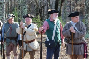
Patriot part-time “militia” soldiers were pushed from Charlotte by the British on Tuesday, September 26, 1780. The militia headed toward the Continental Army in Salisbury, and the Redcoat infantry pursued them up the Salisbury Road (now North Tryon Street). After stopping at two creeks to the south to fire off volleys, two companies of militia re-formed in a line near the intersection with today’s Sugar Creek Road, along a ridgeline.
That ridge is occupied now by the cemetery of Sugaw Creek Presbyterian Church, formed in 1755. At the time it was called “Sugar” Creek, an anglicized version of the Catawba word, which possibly meant “a group of huts.” The chur