Cherokees Celebrate Too Soon
Location
Other maps: Bing, Google, MapQuest.
Coordinates: 35.2500, -82.2738.
Type: Sight
Tour: Overmountain
County: Polk
The coordinates mark a circular pullout where a Daughters of American Revolution (DAR) monument used to be. The pullout offers a clear view of the mountain top.
The mountain is owned by the Saluda Community Land Trust, and there is a route to the top. As of June 2020, about half was fully cleared and maintained, and portions are steep, so only experienced hikers should attempt it. Be prepared for backcountry conditions and hazards such as poison ivy, snakes, and insects.
Please see our Hurricane Helene page about likely impacts to this location from the 2024 floods.
Context
 Amidst growing tensions between the Cherokee Nation and European-American settlers in 1776, a militant band of warriors killed two South Carolina captains sent to negotiate peace.[1]
Situation
Cherokee
The band has withdrawn to the safety of Round Mountain. The men encamp atop the mountain, celebrate, and begin planning an assault on a house/fort called the Block House in what now is Tryon. One man, however, disagrees with their actions. Today’s Cherokee are unsure why. One story says a young European-American had run into Skyuka while hunting turkeys, and threw down his gun as a sign of friendship. When Skyuka offered him several turkeys, Thomas Howard noticed a snakebite on Skyuka’s arm, and invited him home to treat and feed him.[2] Another holds that he was in love with a colonist woman and feared for her life. Of course, both could be true!
Patriot
Men of the area gather at the Block House to plan a response. Skyuka appears and tells 16-year-old Howard where the band is. Perhaps that is why they elect the young man as their captain. Skyuka leads them to a gap in the mountains previously unknown to the whites, now called Howard’s Gap, at the base of Round Mountain.
Date
June 1776 (exact date unknown).
Timeline
Imagine the Scene
Sneaking Up the Gap
Look at the summit of Round Mountain, visible directly across Interstate 26.
Howard’s company arrives in the afternoon, using a trail now marked by the part of Howard Gap Road that parallels the interstate on the other side. They set up camp, likely on a relatively flat area where I-26 runs now. As it gets dark, they start campfires. At the top of the mountain, you see one or more fires flickering and perhaps hear sounds of the Cherokee men celebrating.
Howard picks out three of his men and tells them to move back and forth in front of the militia campfires while making noise. His goal is to make it appear the full company is camped for the night.
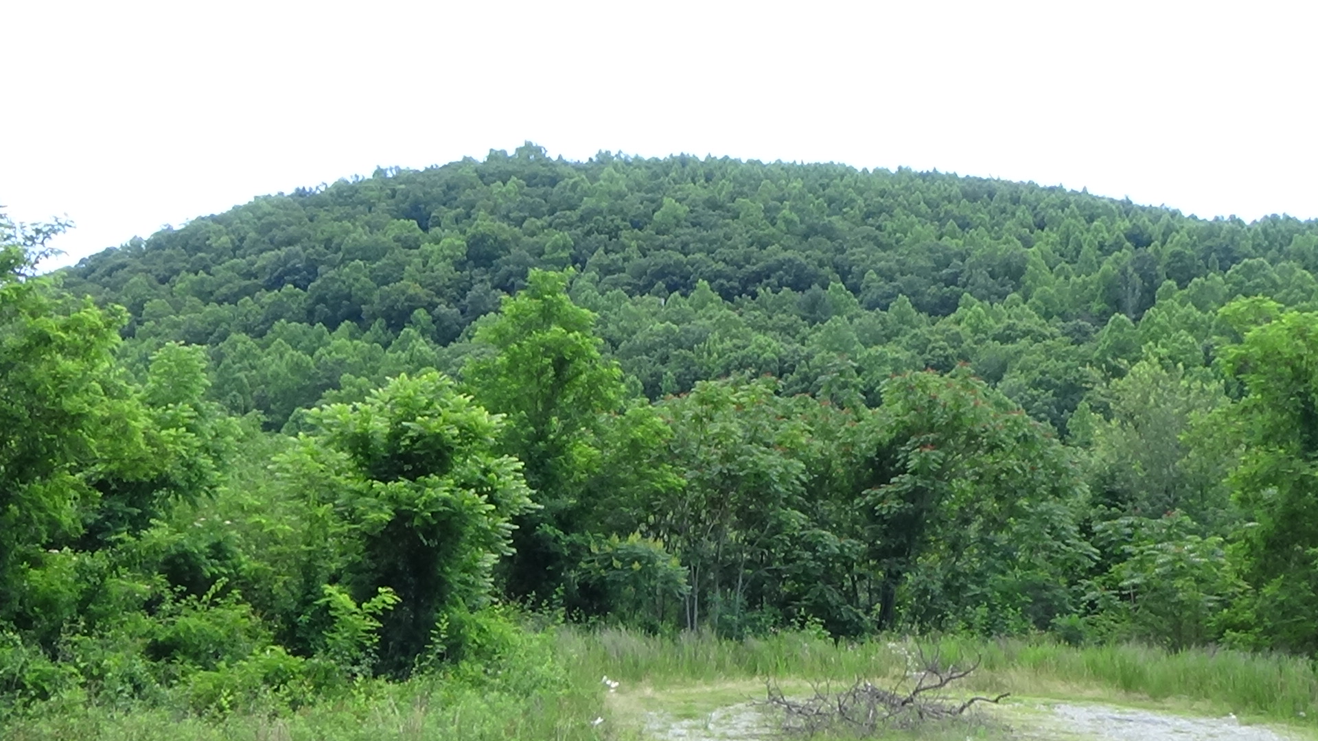
Skyuka leads Howard and the rest of the men further to your right through the gap, which is at the bridge you crossed. The flattest approach to the peak is up that side, plus the Cherokees would not expect an attack from that direction. The company disappears into the woods and ascends around 800 feet in elevation as quietly as they can in the dark.
Some sources claim the warriors were down the slope, or even on the next mountain south.
Surprise at the Summit
You can remain where you are and skip the next paragraph, unless you want to hike the trail.
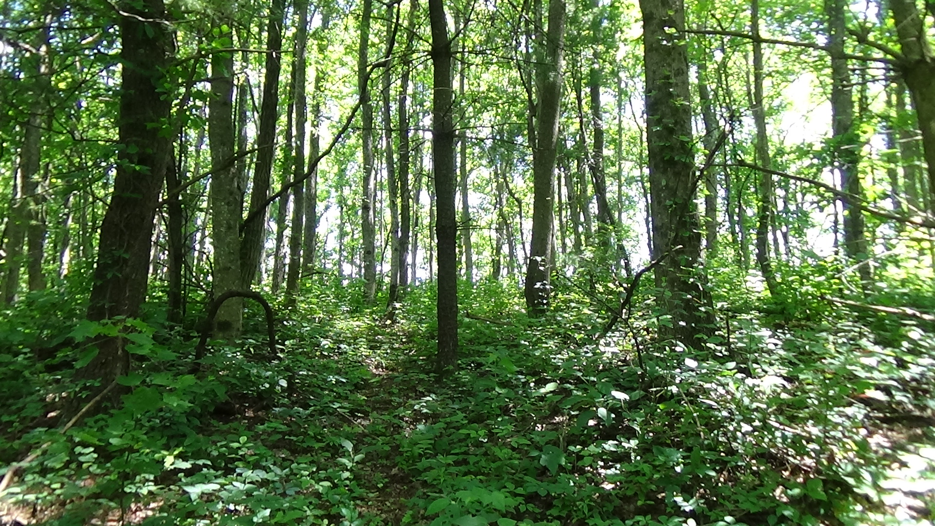
To do that, drive back across the bridge. As Howard Gap Road curves to the right, slow down and look for the gravel double-track road barely visible on the right. You will see a gate and sign up the hill. Park, prepare for the hike (see “Location” above), and walk around the gate. The trailhead is marked by a sign on the left, a little way uphill. Climb to the top. As of 2020, the second half is an old overgrown logging road.
 The summit is a roughly circular, flat area with a clear drop-off on all sides, heavily wooded then as now. An unknown number of warriors are here enjoying themselves. Though no doubt keeping an eye on the militia camp below, the Cherokees are relaxed, feeling well protected by the mountain.
From the pullout, look at the near side of the ridgeline on the right side of the peak.
If you are on the mountain, continue across the summit to where another trail approaches from the far side. Notice the slope is flatter here.
Howard’s company gets as close as it dares, and then spreads out to partially encircle the Cherokee camp. They probably fire a volley into the Natives on a yelled command from Howard, and then rush up to the top. The hand-to-hand fight is brief and most of the surprised warriors are killed. The fate of the rest is lost to history.
The Wandering Monument
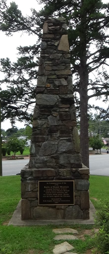
The DAR monument was first erected somewhere near Howard Gap Road in 1908 or 1909. But it had to be dismantled in 1968 for the construction of I-26. In 1977 it was rebuilt in this pullout and rededicated in a DAR ceremony. To protect it from vandals and increase visibility, it was moved again in 2007 to Stearns Park in downtown Columbus. You can see it at the corner of Mills and Hampton streets (coordinates: 35.2521, -82.1987). It says:
In Commemoration of the
1776
Battle of Round Mountain
(located Northwest of here)
in which Captain Thomas Howard
with his brave followers and
his faithful Indian guide, Skyuka,
won the battle against the Cherokee
Battle Map
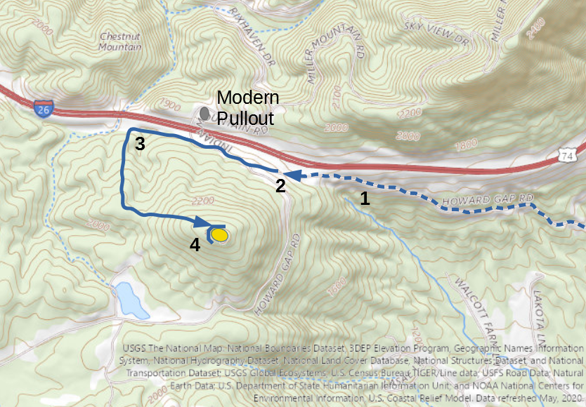
The Battle of Round Mountain: Attack route approximate. 1) Militia led up trail by Skyuka. 2) Militia create campfires, leave three men behind to fake activity. 3) Militia led by Skyuka through Howard Gap and up western slope of mountain. 4) Militia attack Cherokee camp.
Casualties
- Cherokee: Unknown number killed or wounded.
- Militia: 0 killed, unknown wounded.
Historical Tidbits
- The ultimate fate of Skyuka is a mystery. A stream at the base of Tryon Mountain is named for him (you crossed it in Lynn if you came from Columbus). One story holds that he was captured later in the war by Loyalists and Cherokees, and hung from a tree along the stream. Others say he survived the war and lived there with American settlers. By 1780 Howard was serving as a captain in a South Carolina militia unit. A descendant reports that he fought several more times, settled on the Tyger River in the Greenville region after the war, and died in 1832.[3]
- The tallest mountaintop to the north of I-26 between Columbus and Round Mountain is now called Tryon Peak. In 1767, Royal Gov. William Tryon met in western South Carolina with Cherokee leaders and their British agent. They discussed colonists who were violating King George III’s proclamation declaring the mountains off limits beyond the Eastern Continental Divide. Part of the problem was that the border was not clearly marked. The group agreed on a line that now is the border between the S.C. counties of Greenville and Spartanburg and continued straight up to a tree on that peak. “In marking this line, a corridor fifty feet wide on each side of a line of marked trees was cleared or blazed.”[4] If you came from the direction of Columbus, you crossed the line!
More Information
- Bennett, William, Polk County, North Carolina History (Spartanburg, S.C.: The Reprint Company, 1999)
-
‘Genealogy Report: Descendants of Alexander Howard’, Genealogy.Com <https://www.genealogy.com/ftm/o/l/s/Geraldine-A-Olschki/GENE9-0004.html> [accessed 30 March 2024]
- ‘Howard Monument: Battle of Round Mountain, Columbus’, Commemorative Landscapes of North Carolina, 2010 <https://docsouth.unc.edu/commland/monument/299/> [accessed 16 June 2020]
- Lewis, J. D., ‘Round Mountain’, 2009 <https://www.carolana.com/NC/Revolution/revolution_round_mountain.html> [accessed 6 April 2020]
- Malone, Gina, ‘What Is That? Howard Monument’, Hendersonville Times-News (Hendersonville, NC, 7 October 2001) <https://www.blueridgenow.com/article/20151007/News/606018326> [accessed 16 June 2020]
- ‘Marker: P-82’, North Carolina Highway Historical Marker Program <http://www.ncmarkers.com/Markers.aspx?MarkerId=P-82> [accessed 16 June 2020]
- Nutt, Karen, ‘History of Howard Gap Road’, GoUpstate, 2001 <https://www.goupstate.com/article/20010725/News/605183906> [accessed 16 June 2020]
- Patton, Sadie Smathers, Sketches of Polk County History (Spartanburg, S.C.: The Reprint Company, 1976)
- Rozema, Vicki, Footsteps of the Cherokee: A Guide to the Eastern Homelands of the Cherokee Nation, Second (Winston-Salem, NC: John F. Blair, Publisher, 2007)
- Schulman, Mark, ‘Ceremony Rededicates Battle Monument’, Hendersonville Times-News (Hendersonville, NC, 30 November 2007) <https://www.blueridgenow.com/article/20071130/News/606067798> [accessed 16 June 2020]
