A Corps Slows the British Army
Location
Other maps: Bing, Google, MapQuest.
Coordinates: 36.0919, -79.8900.
Type: Sight
Tour: Guilford Battle
County: Guilford
![]() Full
Full
Enter the driveway to the New Garden Friends Meeting House, drive to the far side of the building, and park in the lot next to the cemetery.
Only one comprehensive account of this battle has been published (Newlin 1977). Many details on this page thus come from that book, but the basic facts were confirmed by multiple sources.
Context
 Continental Maj. Gen. Nathanael Greene’s army has occupied high ground along Salisbury Road at Guilford Court House, and awaits an attack by British Lt. Gen. Lord Charles Cornwallis.
Situation
British/Tory
The British army, camped at Deep River Meeting House to the southwest toward Salisbury, has learned of Greene’s location. It left camp before dawn to march on him, led by forces under Lt. Col. Banastre Tarleton. Tarleton had almost 600 cavalrymen and infantry, including German mercenaries called “Hessians.”[1]
Continental/Patriot
Lt. Col. “Light Horse” Henry Lee camped two to three miles from Guilford Court House toward the Quaker settlement of New Garden, to keep an eye on Cornwallis. He had Continental cavalry and infantry plus militia, again around 600 men.[2] Lee sent a small unit on horseback under Lt. James Heard to watch the British overnight. After sending word in the early morning hours that the British appeared to be moving, Heard retired to the New Garden Meeting House to watch for them. (He actually heard a supply party, but the warning gave Lee’s men more time to prepare.) Greene ordered Lee to move toward the British, to give Greene more time to arrange the rest of the troops.
Date
Thursday, March 15, 1781.
Timeline
Imagine the Scene
Meetings at the Meeting House
Walk downhill near the “No Trespassing” sign until you can see into the modern intersection on the left.
 The road alignments have changed a bit, but this was already a major intersection in 1781. The road from Salisbury to Guilford Court House comes up the route of today’s Friendly Avenue to your right. At the time, the meeting house is near you on the right (visited next in the cemetery). Unlike today, the road curves around it toward you. From the other direction, Friendly Avenue is instead New Garden Road, and intersects the Salisbury Road at more of a right angle, probably between the modern sanctuary and intersection. A little to the east (past the current intersection) the old New Garden Road splits off right from a road to Hillsborough, the biggest town between here and the coast at the time. (Today Friendly merges with US 70 past downtown, parts of which follow the original route to Hillsborough.)
Large trees surround the meeting house as far as you can see.[3] The dawn has broken clear and cold, a light frost dusting the ground. In underbrush on either side of Salisbury Road, to the left of the 1781 intersection, is a line of pickets (guards). These are Heard’s men, dismounted and facing south. They have slowly retired here in front of Tarleton’s cavalry.
The curve, meeting house, and trees create a surprise for the British. When Tarleton’s pickets appear around the bend below you, Heard’s fire a volley. The British fire one back. The Continentals begin running up Salisbury Road, where New Garden Road now runs to your left. Perhaps wary of a trap, the cavalry “followed leisurely’” according to Lee, who runs into Heard in that direction and pulls back to set a trap.
That leads to a cavalry clash at our last stop several miles in that direction. Tarleton’s cavalry retreats this way at a gallop. He turns onto a small road across what today is the Guilford College campus, which then had houses of the New Garden settlement. Maybe he mistook it for the Salisbury Road, being unfamiliar with the area, or perhaps he was thinking the main army was closer, and he was getting out of its way. That road, likely a shortcut to the Hillsborough Road, came out on or near today’s Friendly Avenue in the distance. There Tarleton turns right and heads back this direction.
Bullets through the Trees
 Take the nearest paved walkway into the cemetery—not downhill past the trespassing sign! Stop around the large memorial on the right for the Stout family.
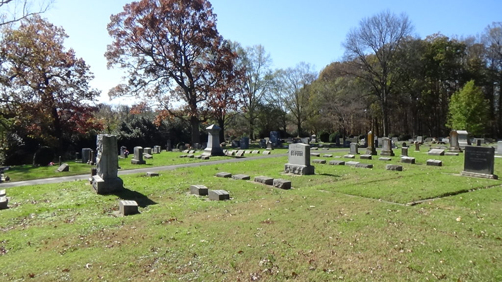
A Quaker meeting house was on this site by 1742, but burned ten years later.[4] The second, built in 1754 as an offshoot of the Cane Creek Meeting House near Snow Camp, was still in use in 1781. Gravestones were already in the cemetery.
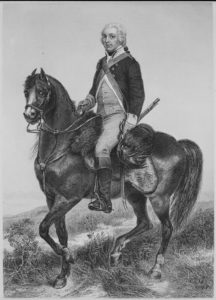
The 25-year-old Lee, following close behind 26-year-old Tarleton, sees an opportunity. He leads his cavalry directly down today’s New Garden Road toward the meeting house here, hoping to cut Tarleton off from the main army. Now, however, the curve, trees, and sanctuary surprise Lee: The first of the British infantry has arrived at the intersection near you! The sun is peeking over the trees. The Redcoats lower their muskets, and the reflections off the barrels spook Lee’s horse. He falls about the time they open fire, and mounts another.[5]
Just after this, Tarleton’s force charges into sight from beyond the intersection. Lee orders a retreat, and they start back up the road followed by the Redcoat infantry. Neither gets far. The Continental cavalry runs into its own infantry, who open fire on the British, halting them. Militia with more accurate and long-ranged rifles under Col. William Campbell arrive to the left of the Continentals, on what now is the college campus, and add their fire. (Campbell commanded the Overmountain Men at the Battle of King’s Mountain, S.C., five months earlier.) The two sides spread into loose lines, the British and Hessians on or near Friendly where it runs south of the meeting house, and the Americans here on the slope of the meeting house grounds. Some riflemen go into the meeting house. They use the window and door openings to shoot, and some knock out holes between the logs. Quickly more than a thousand men on the two sides are firing at close quarters in these woods.[6] (The effective range of muskets of the day is less than 50 yards, half of an American football field.)
For 30–40 minutes, you are standing in a kill zone with lead balls flying by in both directions. The two sides charge and countercharge. Some sources suggest Tarleton loses two fingers here, but more recent research indicates that happened later in the day.[7] Lee claims the British tended to overshoot his cavalry, “so that their caps and accoutrements were all struck with green twigs, cut by British ball out of large oaks in the meetinghouse yard…”[8]
As more men begin to appear in the British line, Lee decides the main part of their army must be nearing. He stations his cavalry to your left to keep Tarleton at bay and orders a retreat. For the British, the Hessians take the lead in following him. The two sides continue a slow-moving fight up the road.
Walk uphill into the cemetery, to the rectangle of bricks in the ground, shown on the right in the picture above.
After the battles here and at the courthouse, the Quakers tend to hundreds of the wounded from both sides. The meeting house is turned into a hospital, and a number of the dead are buried here, as indicated on the memorial.
Just uphill is a marker to the “Revolutionary Oak,” a tree already hundreds of years old at the time, which stood until 1954. That marker claims the cornerstones of the meeting house are nearby, but those apparently were removed sometime after.
While First Lady Eleanor Roosevelt was giving a speech at Guilford College in June 1955, someone set off dynamite under the Revolutionary Oak. No one claimed responsibility or was caught. The tree tilted over slightly, but survived until the remains of Hurricane Gracie knocked it down four years later.[9]
Read the following before you drive to the next stop.
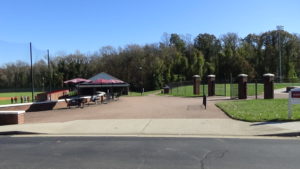
Somewhere along the college parking lot that you will see as you drive, on the right before the main entrance onto the Guilford College campus, was the start of Tarleton’s “shortcut” discussed earlier. It probably ran between the buildings off the southeast corner of the lot, turned more easterly across the modern college quadrangle, and continued between the football and baseball fields on the far side.[10]
Clash at the Cross Roads
Go back to your car and:
- Return to New Garden Road and turn left.
Note: The lot mentioned above is immediately visible to the right. - Drive 0.7 miles, continuing straight onto Fleming Road where New Garden curves right.
- Turn right at the driveway into State Employees Credit Union.
Note: AmRevNC is grateful to this SECU branch for allowing visitors to park in its lot.[11] - Drive to the other entrance on the New Garden side, and park where you can see the intersection you just passed through.
 This intersection pre-dates the Revolutionary War, referred to by locals of the time as the “Cross Roads.” Back then Ballinger Road, across the intersection, continued straight instead of curving toward you. Thus it met New Garden at a right angle, to the left (south) of the modern intersection. Fleming Road to the right was the road to the settlement of Oak Ridge. New Garden, though a narrow wagon road, curved the same way it does today.
Lee’s forces formed lines across New Garden, facing the way you are. They were probably on the uphill side of a stream that runs through the modern woods behind you, below the credit union parking lot. The modern road has clearly been raised; at the time the wagon road would have dropped down to and forded that stream.
The British march up New Garden Road the same way you came and spread into battle lines diagonally across the intersection from you, in what may have been farm fields. They march close enough to exchange volleys with the Continentals, possibly where you sit now.
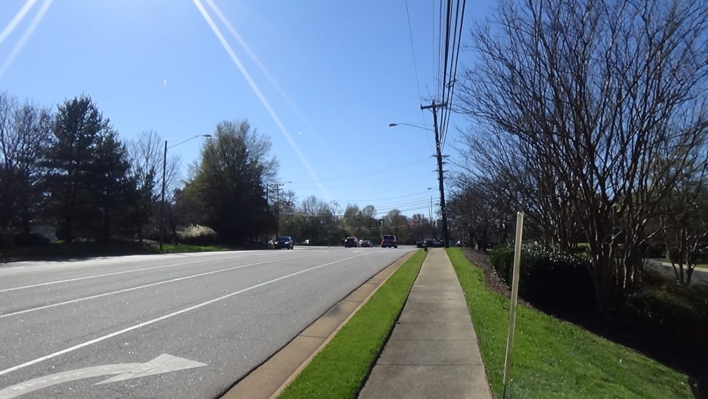
A curious teenager may single-handedly have prevented Lee from getting flanked. In a letter to the college president 100 years later, a local man passed along a story about a 16-year-old, last name Hunt, who lived on current college land near the Cross Roads. He reportedly sneaks to a fence, probably running east-west along a field on the other side of New Garden from the credit union, to watch the battle. But a British cavalry unit appears from the woods where the college is now, and the captain in front sounds the charge on his bugle. By leaping the fence, they could have attacked the side of Lee’s line.
On a dangerous whim, Hunt lifts his musket, fires, and fells the captain. Probably thinking Patriots lined the fence, the unit retreats.[12] As evidence this story could be true, Tarleton later reported the death of one of his cavalry captains in this battle.[13]
The Cross Roads combat continues for half an hour, until Lee sees the British 23rd Regiment of Foot (infantry) come up New Garden from the south. With these men entering the lines, most of Cornwallis’ army is now arrayed against Lee’s much smaller force! Lee wisely orders a withdrawal toward the main army at 11 a.m.
The Long Lane
The scene of the first major action of the day, after the picket skirmish at the meeting house, is a little further up the road:
- From the nearby exit from the lot, turn left to New Garden Road.
Note: During rush hour, it may be easier to go back the way you came, and turn at the stoplight. - Drive 0.6 miles to the Jefferson Elementary School sign.
- Turn right between it and the Price Park sign on the other side.
Park along the road and walk back to the intersection. (Or to stay in your vehicle, read the following first, then turn around and pause at the stop sign if you can.)
Here where it curves left, Lee describes New Garden Road as “‘a long lane, with high curved fences on either side of the road.’”[14] It most likely runs where the median is today. Open farm fields must be on either side, which would explain the fences. In those days, ranchers could allow their animals to roam freely under state law, so farmers had to put up fences to protect their crops.
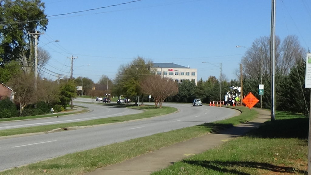
Lee’s cavalry and Heard’s men retire to this point after Heard’s exchange of volleys with the British pickets. Though unclear from the records, it seems that Lee has some of his men form lines within the lane near here.
Look left down New Garden Road.
The green-coated cavalry of Tarleton appears in the distance, sees the small force here, and attacks at a gallop. However, it cannot maneuver thanks to the fences, and the Whigs drive him off. A second attack fails as well, and then you hear thundering hooves from the other direction: Lee has ordered his horsemen, also in green coats, to charge. They may have started from past the fences on the far side of the road, because he mentions them wheeling right before attacking. The men in the lane take the “point,” the front of the attack, as all open fire and charge. Some of Tarleton’s men fall immediately. As the British try to turn around and retreat, Lee says most of those in front are knocked off their horses and some are taken prisoner, with no casualties among his men.[15]
Tarleton retreats back to the shortcut and main action described earlier at the Meeting House. Lee’s force passes back this way after the fight at the Cross Roads, followed by the entire British army.
If you are visiting the Guilford battlefield next, just turn right and follow them!
Battle Map
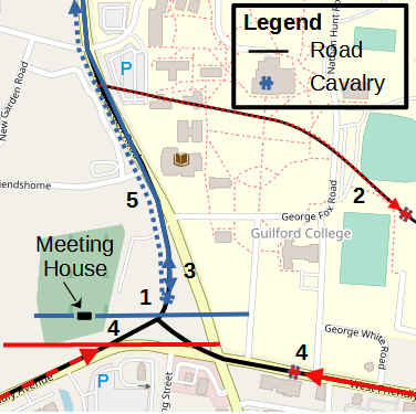
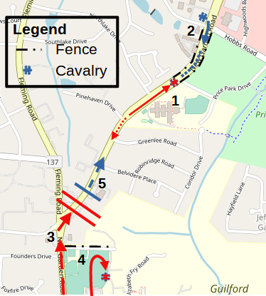
Meeting House, The Battle of New Garden: All locations are approximate. 1) Not illustrated: Continental, British pickets exchange volleys; Americans withdraw, British cavalry follows. 2) After Long Lane skirmish, British cavalry retreats, takes side road. 3) American cavalry goes straight to intersection, finds British infantry, turns back. 4) Americans return with infantry and militia, exchange fire as British cavalry returns. 5) As more British arrive, Americans withdraw to Cross Roads.
Lane and Cross Roads, The Battle of New Garden: All troop and fence locations are approximate. 1) After initial skirmish at Meeting House, British cavalry attack Continentals twice. 2) Continental cavalry charges, drive British off. 3) After firefight at Meeting House, Continentals withdraw to heights above Cross Roads. 4) Teen’s shot drives off a British cavalry unit. 5) After delaying British infantry, Continentals retire.
Casualties
After the Battle
In addition to those in the New Garden cemetery, bodies are buried along New Garden Road and in a plot on the heights behind the American position at the Cross Roads. At least into the late 1800s, people in England sent payments to the Ballinger family to maintain a small graveyard there. But those stopped, and all traces have vanished. (As president in 1792, George Washington breakfasted at John Ballinger’s home on New Garden Road on his way to the courthouse battleground, during his tour of the southern states.)
Historians mistakenly treated the events at New Garden as a single cavalry skirmish of no significance to the later battle. Research by Guilford College alumnus and history professor Algie Newlin in 1977, mentioned under “Location,” revealed the battle’s significance and gave it a name.[16] Lee’s forces engaged the British for at least a couple of hours, including most of their army at the end; inflicted significant casualties; and fatigued them on top of their early morning march. Each of these factors no doubt played a significant role in the damage done to the British later in the day. Had this happened the day before, it surely would have been seen as a separate battle.
Historical Tidbits
- Dolley Payne was born in New Garden in 1768. Her parents moved back to their home state of Virginia when she was a baby, and eventually to Philadelphia. She married there, but her husband and one son died of yellow fever when she was 25. A Virginia congressman asked Aaron Burr—who later killed Alexander Hamilton in a duel—for an introduction, and in 1794, she married that man. James Madison went on to become president. Dolley Madison became famous for rescuing a painting of George Washington before the British burned the White House in the War of 1812. (Though her name is often spelled “Dolly,” her birth certificate said “Dolley.”)
- The Meeting House and nearby Guilford College woods are considered the southern-most stop on the “Underground Railroad,” the series of safe houses that helped enslaved people escape to freedom prior to the Civil War.
More Information
- Babits, Lawrence, and Joshua Howard, Long, Obstinate, and Bloody: The Battle of Guilford Courthouse (Chapel Hill: The University of North Carolina Press, 2009)
- Barefoot, Daniel, Touring North Carolina’s Revolutionary War Sites (Winston-Salem, NC: John F. Blair, Publisher, 1998)
- ‘Battle of New Garden Meetinghouse’, American Revolutionary War, 2017 <https://revolutionarywar.us/year-1781/battle-new-garden-meetinghouse/> [accessed 17 January 2020]
- Butler, Lindley, ‘New Garden, Battle Of’, NCpedia, 2006 <https://www.ncpedia.org/new-garden-battle> [accessed 17 January 2020]
- Caruthers, E. W. (Eli Washington), Interesting Revolutionary Incidents and Sketches of Character, Chiefly in the ‘Old North State.’ (Philadelphia : Hayes & Zell, 1856) <http://archive.org/details/interestingrevol00incaru> [accessed 23 April 2020]
- ‘Copy of Sketch of New Garden Quaker Community, Guilford Co., North Carolina, Time of Battle of Guilford Court House, March 15, 1781: Family Records Collection’ <http://digital.ncdcr.gov/cdm/ref/collection/p15012coll1/id/9610> [accessed 17 January 2020]
- Hilty, Hiram H., New Garden Friends Meeting: The Christian People Called Quakers (Greensboro, N.C.: North Carolina Friends Historical Society, New Garden Friends Meeting, 2011) <http://archive.org/details/newgardenfriends00hilt> [accessed 4 August 2020]
- Lee, Henry, Memoirs of the War in the Southern Department of the United States, Second Edition (Washington, D.C.: Peter Force, 1827), Google-Books-ID: DpwBAAAAMAAJ
- Lewis, J.D., ‘New Garden Meeting House’, The American Revolution in North Carolina, 2012 <https://www.carolana.com/NC/Revolution/revolution_new_garden_meetinghouse.html> [accessed 17 January 2020]
- ‘New Garden Friends Meeting’, New Garden Friends Meeting <https://ngfm.org/> [accessed 16 January 2020]
- Newlin, Algie, The Battle of New Garden (Greensboro, NC: North Carolina Friends Historical Society, New Garden Friends Meeting, 1977)
- ‘Quakers at the Battle of Guilford Courthouse – Guilford Courthouse National Military Park’, S. National Park Service <https://www.nps.gov/guco/quakers-at-the-battle-of-guilford-courthouse.htm> [accessed 4 August 2020]
- ‘Quaker Meeting House Site of Skirmish Prior to Guilford Courthouse | NC DNCR’ <https://www.ncdcr.gov/blog/2017/04/10/quaker-meeting-house-site-skirmish-prior-guilford-courthouse> [accessed 17 January 2020]
- Tarleton, Banastre, A History of the Campaigns of 1780 and 1781, in the Southern Provinces of North America (London : Printed for T. Cadell, 1787) <http://archive.org/details/historyofcampaig00tarl> [accessed 19 September 2020]
[1] Newlin 1977.
[2] Ibid.
[3] Ibid.
[4] Hilty 2011.
[5] Lee 1827. A reverend who collected war stories from eyewitnesses in the middle 1800s (Caruthers 1856) says Lee’s horse is captured by a local farmer the next day, who sells him to Tarleton. No independent source reports this story, however, including Tarleton’s memoir (1787).
[6] Newlin.
[7] Babits and Howard 2009.
[8] Quoted in Newlin.
[9] Benjamin, Dorothy Ann, ‘Guilford Tree 450 Years Old Toppled by Storm’s Backlash’, Greensboro Daily News (21 October 1959); Hilty 2011.
[10] Newlin.
[11] Staff, SECU New Garden Road Branch, In-person interview, 12/8/2020.
[12] Letter from Addison Coffin, quoted in Newlin.
[13] Tarleton 1787.
[14] Quoted in Newlin.
[15] Ibid.
[16] Newlin.
← Caldwell Homesite | Guilford Battle Tour | Guilford Court House →
