A Trap Fails to Close
Location
Other maps: Bing, Google, MapQuest.
Coordinates: 36.0350, -79.5269.
Type: Stop
Tour: Regulators
County: Alamance
![]() Full
Full
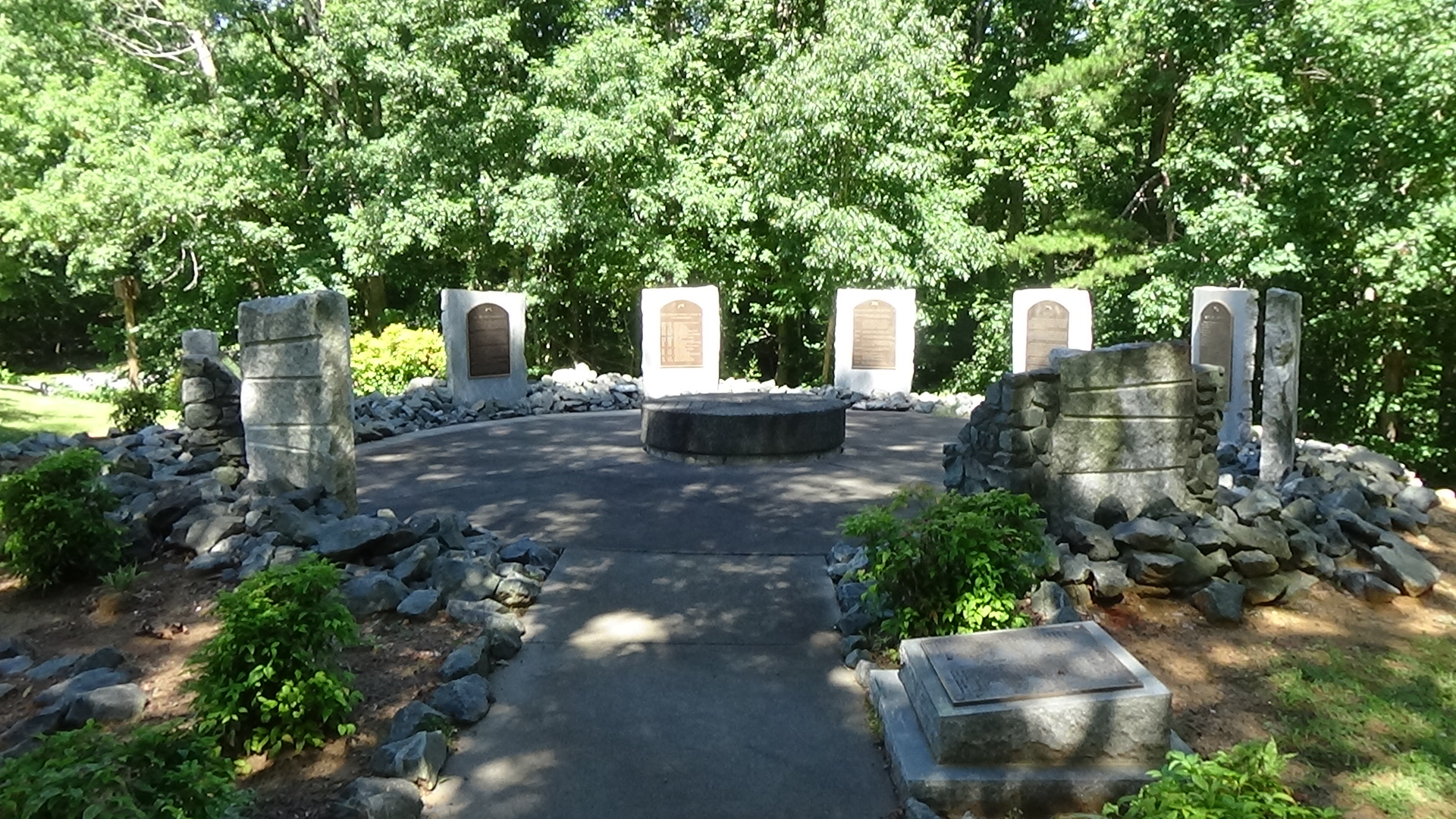
The coordinates take you to a set of markers on the grounds of Lake Mackintosh Park & Marina, which is closed Mondays, Tuesdays, and some holidays. After entering the grounds, take the first right, at the small sign saying “Clapp’s Mill Historic Site.” It leads to a circular parking lot. Most of the way around on the left, a short sidewalk takes you to a circle of markers about the battle. (Do not use the sidewalk below the markers.) Face the first marker on the right, which has a map of this battle.
Description
 After the Race to the Dan in early 1781, Continental Maj. Gen. Nathanael Greene returned to North Carolina from Virginia to confront the British Army. However, for a time he changed his army’s positions frequently, delaying that confrontation until he could gather more part-time “militia” soldiers. A “Light Corps” under Col. Otho Williams, built for rapid movement, was screening him from the British.
On Friday, March 2, Williams sent a detachment under Lt. Col. Henry Lee, mostly militia except Lee’s cavalry, south (in this direction) across Big Alamance Creek, where the lake is now. They took a road passing at or near the picnic shelter toward Clapp’s Mill.
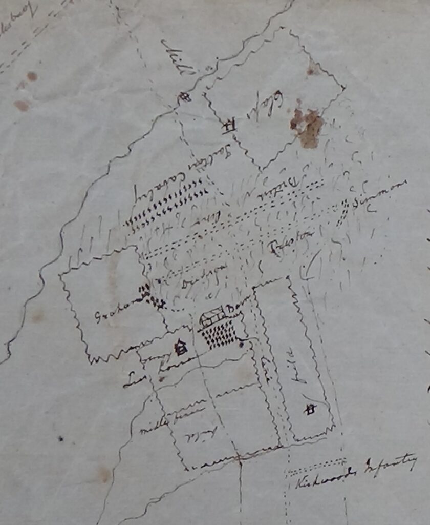
Learning from Lee’s scouts that the British were approaching, Williams planned an ambush near the mill. That was built in 1763 on the next creek south, Beaver Creek—to the right as you look out from the entrance to the markers. The main British army was camped on the other side of that creek, partially on the Alamance battlefield from the Regulator War of ten years earlier.
The scouts had seen a force of hundreds under Lt. Col. Banastre Tarleton moving up a road that passes the mill. They were approaching because a British officer guarding a foraging party had spotted the Patriots, sent the party back, and notified Tarleton. Cornwallis is following with the main army in hopes of trapping Williams and forcing Greene to come to the rescue.
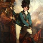
On what now is a peninsula of the lake along Pond Road to the south, Lee lined his force behind a rail fence on a farm near the mill, with cavalry hidden in woods on either side. Lee knew Tarleton tended to be overly aggressive, and indeed, Tarleton led his cavalry right into the trap. The Continental regulars and Patriot militia fired a volley and Tarleton pulled back.
He sent forward an infantry unit with bayonets affixed, with his cavalry to the left in thick woods to cover the flank. Patriot guns drove them back, and Catawbas allied with the Patriots led a counterattack. According to militia Col. Joseph Graham: “‘one of the Indians snorted like a deer, whereupon he and his comrades ran forward a few steps to the first timber, and fired.'”[1]
For 20 minutes the two sides exchanged fire. Many of the Patriot militia began to panic, however, and run away. Lee attempted to rally them. Realizing they would not hold under a second bayonet charge, he ordered them to make their way back across Alamance Creek in groups, to make pursuit by Tarleton’s horsemen difficult. They retreated a mile back to the ford, which was guarded on the other side by the rest of Williams’ force. Thick underbrush made escape difficult, but also made pursuit hard for the British, who gave up less than halfway.
The British lost at least one killed and had 30 wounded; one of the markers cites a much higher death count of 16. The Patriots had at least two killed, three wounded, and seven captured—eight killed according to the marker. (The discrepancy between it and all other sources may come from the marker including men who died later of their wounds.)
What to See
Step to the other side of the circle entrance and read the markers clockwise. They cover the mill history, local population, campaign, battle, and aftermath.
You can visit the remaining portion of the battlefield, though no obvious remnants are visible. To do so:
- At the marina exit, turn left onto Huffman Mill Road.
- Near the bottom of the hill, take the second left, Pond Road, which angles back toward you.
- The road curves gently to the right, and then more sharply to the left.
At that point on the day of the battle, you would probably be behind the right wing of the Continental front line, which was facing to your right, in thick woods. The 1782 road shown on the map at the markers, which was flanked by both armies, was somewhere near the top of the hill. It possibly ran along the north-south ridgeline. The mill, its remains now underwater, was on the creek by that road at the bottom of the hill to your right.
More Information
- ‘Battle of Clapp’s Mill’ <http://steveclapp.com/places/ClappMill.htm> [accessed 26 December 2019]
-
Graham, Joseph, ‘Sketch of the Ground and the Position of the British and Americans at the Battle near Clapp’s Mill Fought on the 1st Day of March 1781’, State Archives of North Carolina, P.C. 60.1-2: Joseph Graham Papers 1780-1836, ‘Articles: August 6, 1780-March 10, 1781’
- Lewis, J.D., ‘Clapp’s Mill’, The American Revolution in North Carolina, 2011 <https://www.carolana.com/NC/Revolution/revolution_clapps_mill_1.html> [accessed 26 December 2019]
- ‘Marker: G-111’, North Carolina Highway Historical Marker Program <http://www.ncmarkers.com/Markers.aspx?MarkerId=G-111> [accessed 25 June 2020]
- Rankin, Hugh F., The North Carolina Continentals (Chapel Hill: The University of North Carolina Press, 1971)
- Sherman, Wm. Thomas, Calendar and Record of the Revolutionary War in the South: 1780-1781, Tenth Edition (Seattle, WA: Gun Jones Publishing, 2007) <https://www.americanrevolution.org/calendar_south_10_ed_update_2017.pdf>
