Location
Other maps: Bing, Google, MapQuest.
Coordinates: 34.2214, -77.9827.
Type: Sight
Tour: Cape Fear
County: Brunswick
 Full
Full
Park in the lot near the entrance of the Brunswick Riverwalk off NC 133.
This tour visits a grassy area and sandy trail that are relatively flat, and the latter is wheelchair accessible. Some people with mobility issues may need assistance, however. You can also just remain in your vehicle.
Context
A British corps of 300 under Maj. James Craig occupied Wilmington in January 1781.
Situation
Loyalist
Loyalist or “Tory” supporters of the king formed militia companies of part-time soldiers to regain control of Southeastern North Carolina for the British and gather supplies for Craig’s force.
Patriot
In October, North Carolina sent Brig. Gen. Griffith Rutherford and 1,000 men or more from the western part of the state to suppress the Loyalists and remove Craig. The main force moved around to the north, ending up at Heron’s Bridge nine miles above town. Maj. Joseph Graham’s unit was one of several detached under Col. Robert Smith to approach Wilmington directly from the west.
Date
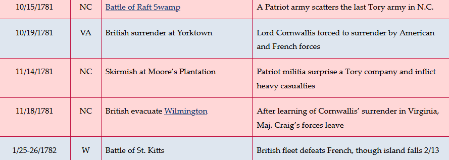
Wednesday, November 14, 1781.
Timeline